Sites and Monuments Record · Ireland
Headstone
Caherabbey Upper, County Tipperary South, Ireland
The record
- Townland
- Caherabbey Upper
- County
- Tipperary South
- Country
- Ireland
- First-edition OS map
- Not indicated
- Latest-edition OS map
- Not indicated
- Coordinates
- 52.38222, -7.93900
- SMR number
- TS075-081----
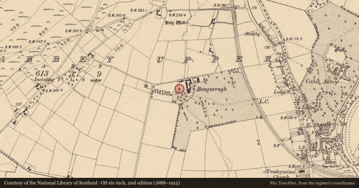
Slide toward Today to fade the historical sheet and see the modern map underneath.
David Rumsey Map Collection, Stanford LibrariesDavid Rumsey Map Collection, Stanford LibrariesDavid Rumsey Map Collection, Stanford LibrariesDavid Rumsey Map Collection, Stanford Libraries
4 historical maps cover this location, the earliest the 1790 map "Composite: Ireland." (David Rumsey Map Collection, Stanford Libraries).
Historical maps covering this location
- 1790 · Composite: Ireland. (David Rumsey Map Collection, Stanford Libraries)
- 1882 · Ireland (southern half). (David Rumsey Map Collection, Stanford Libraries)
- 1891 · Ireland 16 (David Rumsey Map Collection, Stanford Libraries)
- 1904 · Sheet 13. (David Rumsey Map Collection, Stanford Libraries)
This record in the National Monuments Service's Historic Environment Viewer ↗
The National Monuments Service's description
Embedded upright in the grounds of Bengurragh House, 0.6m S of the S wall of the wall garden and 30m W of house. This late 17th-century headstone (H 0.46m above ground; Wth 0.39m; T 0.13m), the upper sinister angle is broken off. The english inscription, in an naive style, reads, 'Here Li... Bodi Of M[?]... the wife of I. F. deceaced the 2[nd] of No[vem]ber 1675'. Sadleir (1910-12, vol. 8, 628) states that, 'The house at Bengurragh, formerly called Upper Cahir Abbey, was built by a Quaker named Fennell. According to local tradition this stone was erected by one of his ancestors, and removed by him from Cottage Hill Cemetery, which Lord Glengall, in order to extend his park, cleared, early in the last century [1800s], breaking the headstones and throwing the remains into the Suir'.
Compiled by: Jean Farrelly
Date of upload: 24 June 2013
References
Sadleir, T. U. 1910-12 County Tipperary: Bengurragh Demesne, Cahir Parish. In Fitzgerald, W. (ed.) Journal of the Association for the Preservation of the Memorials of the Dead in Ireland, vol. 8, 628.
Nearby in the register
- Ritual site - holy wellunder 1 mi
- Cross-slab (present location)under 1 mi
- Enclosureunder 1 mi
- Ringfort - rathunder 1 mi
Other entries of the same register within about three miles of this one, by straight line.