Sites and Monuments Record · Ireland
Ringfort - rath
Monaraha, County Tipperary South, Ireland
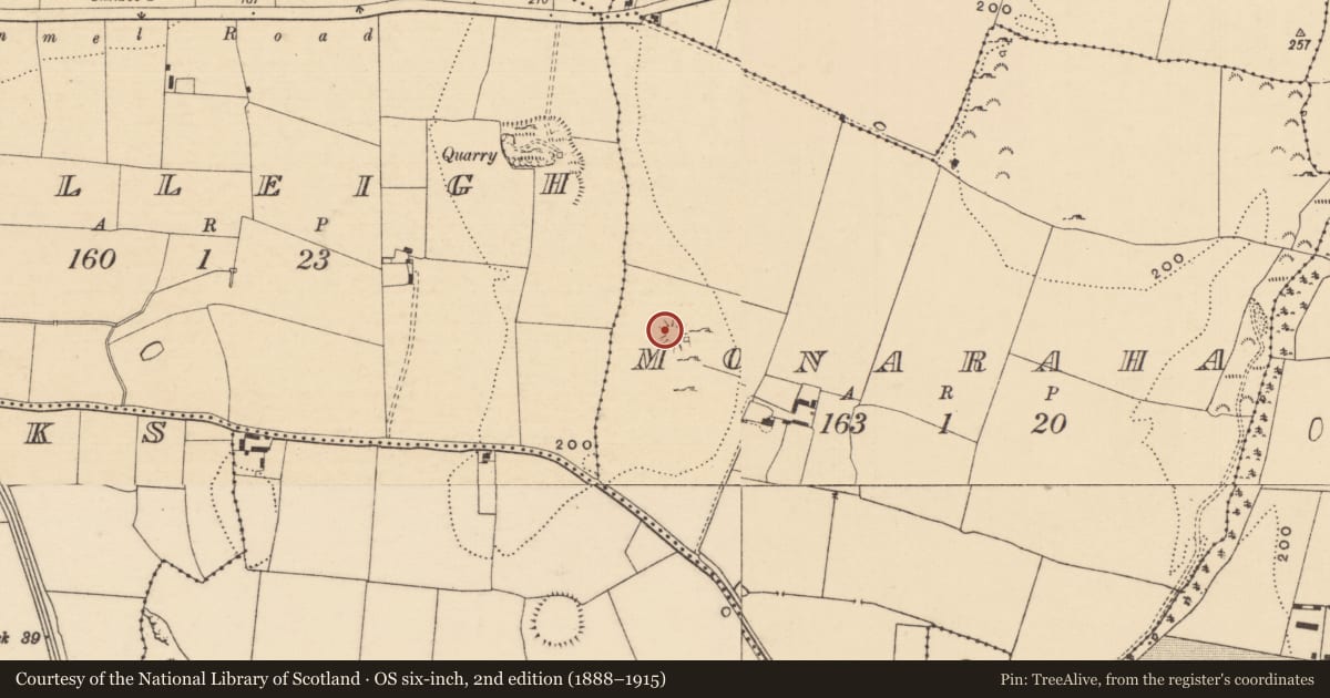
The record
- Townland
- Monaraha
- County
- Tipperary South
- Country
- Ireland
- First-edition OS map
- Hachured
- Latest-edition OS map
- Hachured
- Coordinates
- 52.37340, -7.90062
- SMR number
- TS075-051----
Slide toward Today to fade the historical sheet and see the modern map underneath.
David Rumsey Map Collection, Stanford LibrariesDavid Rumsey Map Collection, Stanford LibrariesDavid Rumsey Map Collection, Stanford LibrariesDavid Rumsey Map Collection, Stanford Libraries
4 historical maps cover this location, the earliest the 1790 map "Composite: Ireland." (David Rumsey Map Collection, Stanford Libraries).
Historical maps covering this location
- 1790 · Composite: Ireland. (David Rumsey Map Collection, Stanford Libraries)
- 1882 · Ireland (southern half). (David Rumsey Map Collection, Stanford Libraries)
- 1891 · Ireland 16 (David Rumsey Map Collection, Stanford Libraries)
- 1904 · Sheet 13. (David Rumsey Map Collection, Stanford Libraries)
This record in the National Monuments Service's Historic Environment Viewer ↗
The National Monuments Service's description
Just off summit of hill on NE facing slope. SSW quadrant is on summit. Surrounding meadow cut for sileage. Monument covered by grass, nettles and some thistles. Large quarry immediately SE exploiting the limestone sub-strata of the hill, with limekiln built into S quadrant of the monument. Ringfort (TS075-050----) visible c. 250m to NW. Circular site (diam. 24.3m N-S; 23m E-W) enclosed by bank (Wth 1.6-1.8m crest, 2.5-3.5m base; int. H 0.37-0.72m; in N and W quadrant respectively, ext. H 0.52m). Lot of stones and small boulders protruding from bank. Entrance (Wth 2m) in S quadrant. Bank in NNW sector is denuded, giving the appearance of a right-angle at this point. Quarry edges into the E side of ringfort and has partially tuncated this sector. Possible field bank runs N of site in NW quadrant, curving to NE and NW. May also be upcast from small scale quarrying, however, bank appears to join N bank of ringfort and may be contemporary.
Compiled by: Jean Farrelly
Date of upload: 26 August 2011
Nearby in the register
- Ringfort - rathunder 1 mi
- Ringfort - rathunder 1 mi
- Enclosureunder 1 mi
- Ringfort - rathunder 1 mi
Other entries of the same register within about three miles of this one, by straight line.