Sites and Monuments Record · Ireland
Megalithic tomb - portal tomb
Lissava, County Tipperary South, Ireland
The record
- Townland
- Lissava
- County
- Tipperary South
- Country
- Ireland
- First-edition OS map
- Not indicated
- Latest-edition OS map
- Not indicated
- Coordinates
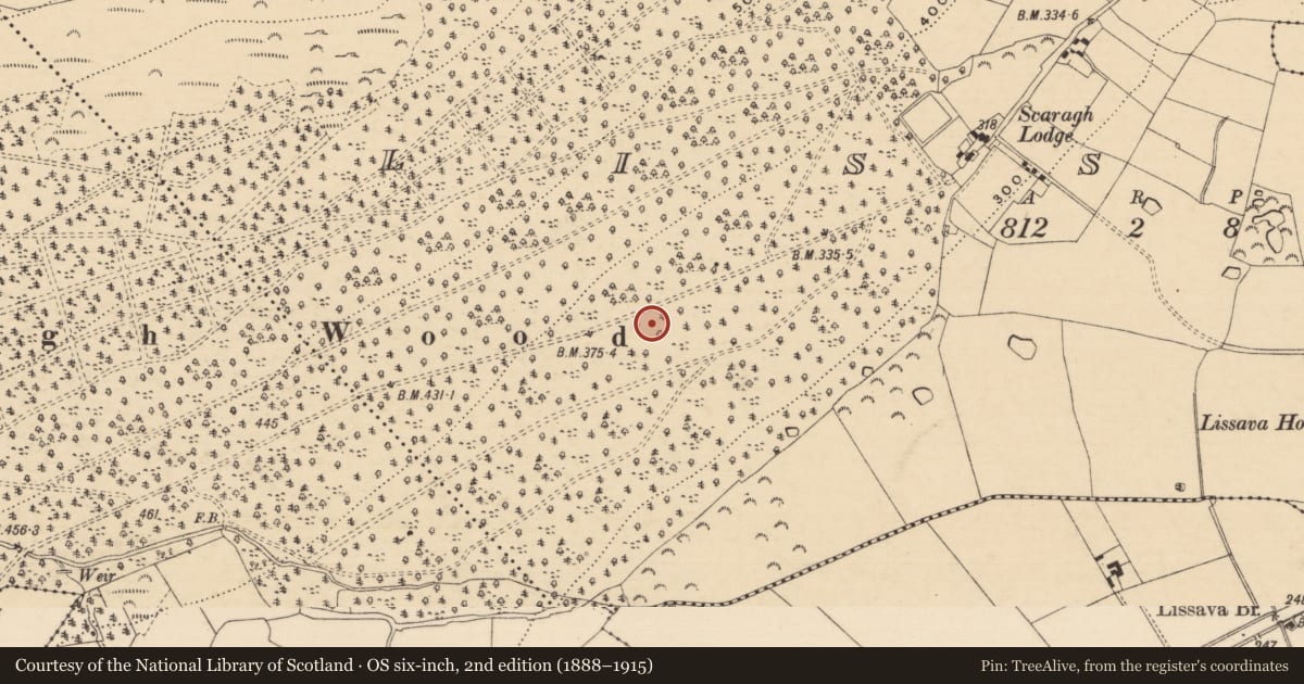
- 52.37494, -7.96372
- SMR number
- TS075-045----
Slide toward Today to fade the historical sheet and see the modern map underneath.
David Rumsey Map Collection, Stanford LibrariesDavid Rumsey Map Collection, Stanford LibrariesDavid Rumsey Map Collection, Stanford LibrariesDavid Rumsey Map Collection, Stanford Libraries
4 historical maps cover this location, the earliest the 1790 map "Composite: Ireland." (David Rumsey Map Collection, Stanford Libraries).
Historical maps covering this location
- 1790 · Composite: Ireland. (David Rumsey Map Collection, Stanford Libraries)
- 1882 · Ireland (southern half). (David Rumsey Map Collection, Stanford Libraries)
- 1891 · Ireland 16 (David Rumsey Map Collection, Stanford Libraries)
- 1904 · Sheet 13. (David Rumsey Map Collection, Stanford Libraries)
This record in the National Monuments Service's Historic Environment Viewer ↗
The National Monuments Service's description
On the break of a S-facing slope of Bain at the eastern end of the Galty mountains, in forestry. Deciduous scrub and ferns are reclaiming the slope after previous vegetation was burnt. Extensive view to E and S but blocked upslope to N and by trees to W. Possible portal tomb (per. comm. Paul Walsh 1991) consisting of a large sandstone conglomerate slab (dims. 2.8m x 2.94m) partially resting on a triangular-shaped side-stone (H 0.91m ext., 1.23m int.; max. L 1.07m; T 0.28m) to the SW, sloping down to the NE where it rests on the ground. Aligned NW-SE presuming that the triangular stone is a side-stone. A distinct linear depression (Wth 0.23-0.32m; D 0.02-0.08m) runs NE-SW across the centre of the capstone. There is a lot of stone rubble in the chamber. There is a rectangular block of quartz (dims. 0.22m x 0.36m) lying loose immediately NE of tomb and a scatter of rubble extends c. 3m SW of the tomb. There is also a mound of rubble (dims. c. 3.5m x 2.5m; H 1.2m) 1.5m to N.
Compiled by: Jean Farrelly
Date of upload: 25 June 2015
Nearby in the register
- Ringfort - rathunder 1 mi
- Ringfort - rathunder 1 mi
- Castle - unclassifiedunder 1 mi
- Ring-ditchunder 1 mi
Other entries of the same register within about three miles of this one, by straight line.