Sites and Monuments Record · Ireland
Megalithic tomb - passage tomb
Shrough, County Tipperary South, Ireland
The record
- Townland
- Shrough
- County
- Tipperary South
- Country
- Ireland
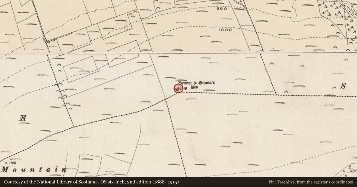
- First-edition OS map
- Dermot & Granias Bed
- Latest-edition OS map
- Dermot & Granias Bed
- Coordinates
- 52.42694, -8.23273
- SMR number
- TS073-007----
Slide toward Today to fade the historical sheet and see the modern map underneath.
David Rumsey Map Collection, Stanford LibrariesDavid Rumsey Map Collection, Stanford LibrariesDavid Rumsey Map Collection, Stanford LibrariesDavid Rumsey Map Collection, Stanford Libraries
4 historical maps cover this location, the earliest the 1790 map "Composite: Ireland." (David Rumsey Map Collection, Stanford Libraries).
Historical maps covering this location
- 1790 · Composite: Ireland. (David Rumsey Map Collection, Stanford Libraries)
- 1882 · Ireland (southern half). (David Rumsey Map Collection, Stanford Libraries)
- 1891 · Ireland 16 (David Rumsey Map Collection, Stanford Libraries)
- 1904 · Sheet 13. (David Rumsey Map Collection, Stanford Libraries)
This record in the National Monuments Service's Historic Environment Viewer ↗
The National Monuments Service's description
On the summit of Shrough Hill, part of the Slievenamuck/Moanour mountains, with forestry encroaching to within 10m to N, E and W, forestry to W has been felled affording an extensive view of the Galty mountains and foothills below. A cairn, possibly a passage tomb (LI058-001----), is visible on Temple Hill c. 9km to the SSE, at the W end of the Galtys. A stone wall runs E-W along the S edge of the mound. The monument consists of a roughly circular cairn (diam. 30m; H 2m) with a small, roofless polyogonal chamber (int. dims. L 2.2m; Wth 1.2m), aligned roughly E-W, near the centre of the cairn (De Valera and Ó Nualláin 1982, 101; Ó Nualláin and Cody 1987, 76-8). The sidestones vary in height from 1.2m to 1.8m (ibid. 76). The cairn is overgrown with gorse, heather and low scrub.
Compiled by: Jean Farrelly
Date of upload: 26 August 2011
See linked document with details from Ruaidhrí de Valera and Seán Ó Nualláin, Survey of the Megalithic Tombs of Ireland. Volume IV. Counties Cork, Kerry, Limerick, Tipperary. (Dublin: Stationery Office, 1982)
Nearby in the register
- Ringfort - rathunder 1 mi
- Enclosureunder 1 mi
- Quarryunder 1 mi
- Ringfort - rathunder 1 mi
Other entries of the same register within about three miles of this one, by straight line.