Sites and Monuments Record · Ireland
Dovecote
Kiltinan, County Tipperary South, Ireland
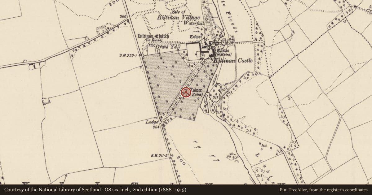
The record
- Townland
- Kiltinan
- County
- Tipperary South
- Country
- Ireland
- First-edition OS map
- Turret
- Latest-edition OS map
- Tower (in Ruins)
- Coordinates
- 52.43741, -7.65868
- SMR number
- TS070-101007-
Slide toward Today to fade the historical sheet and see the modern map underneath.
David Rumsey Map Collection, Stanford LibrariesDavid Rumsey Map Collection, Stanford LibrariesDavid Rumsey Map Collection, Stanford LibrariesDavid Rumsey Map Collection, Stanford Libraries
4 historical maps cover this location, the earliest the 1790 map "Composite: Ireland." (David Rumsey Map Collection, Stanford Libraries).
Historical maps covering this location
- 1790 · Composite: Ireland. (David Rumsey Map Collection, Stanford Libraries)
- 1882 · Ireland (southern half). (David Rumsey Map Collection, Stanford Libraries)
- 1891 · Ireland 16 (David Rumsey Map Collection, Stanford Libraries)
- 1904 · Sheet 13. (David Rumsey Map Collection, Stanford Libraries)
This record in the National Monuments Service's Historic Environment Viewer ↗
The National Monuments Service's description
In gently undulating, though relatively flat, terrain. Kiltinan castle (TS070-101004-) is located 200m to the NE. The NW side of the dovecote is built into a low slope (H above the exterior to the SE 3.45m; H above the exterior to the NW 1.7m). This circular structure (int. diam. 2.86m) is constructed of limestone rubble, roughly coursed (wall T 1.25m) with a steep stone corbelled roof (H c. 3m) which has a central circular opening of well-cut and dressed stones. The doorway (H 1.05m; Wth 0.95m) in the NE facing wall has a re-used jamb (L 0.55m; Wth 0.26m; D 0.32m) dressed with punch-tooling within drafted margins with an external chamfer (Wth 0.1m) and internal rebate (D 0.08m) and the lintel is a re-used sill or lintel (L at least 1m; Wth 0.21m; D 0.22m) of a single light window (Wth 0.49m) with an external chamfer (Wth 0.1m). The nesting boxes (H 0.15-0.16m; Wth 0.22-0.25m; D 0.27m) consisting of horizontal and vertical slabs, are largely broken, the best preserved being in the NW, SSW and above the doorway.
Compiled by: Jean Farrelly
Date of upload: 26 August 2011
Nearby in the register
- Bawnunder 1 mi
- Castle - Anglo-Norman masonry castleunder 1 mi
- Sheela-na-gig (present location)under 1 mi
- Graveyardunder 1 mi
Other entries of the same register within about three miles of this one, by straight line.