Sites and Monuments Record · Ireland
House - 17th century
Fethard, County Tipperary South, Ireland
The record
- Townland
- Fethard
- County
- Tipperary South
- Country
- Ireland
- First-edition OS map
- Indicated
- Latest-edition OS map
- Indicated
- Coordinates
- 52.46597, -7.69423
- SMR number
- TS070-040023-
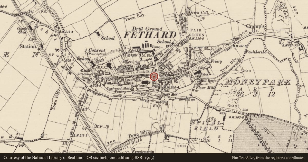
Slide toward Today to fade the historical sheet and see the modern map underneath.
David Rumsey Map Collection, Stanford LibrariesDavid Rumsey Map Collection, Stanford LibrariesDavid Rumsey Map Collection, Stanford LibrariesDavid Rumsey Map Collection, Stanford Libraries
4 historical maps cover this location, the earliest the 1790 map "Composite: Ireland." (David Rumsey Map Collection, Stanford Libraries).
Historical maps covering this location
- 1790 · Composite: Ireland. (David Rumsey Map Collection, Stanford Libraries)
- 1882 · Ireland (southern half). (David Rumsey Map Collection, Stanford Libraries)
- 1891 · Ireland 16 (David Rumsey Map Collection, Stanford Libraries)
- 1904 · Sheet 13. (David Rumsey Map Collection, Stanford Libraries)
This record in the National Monuments Service's Historic Environment Viewer ↗
The National Monuments Service's description
On the S side of Main St, Fethard, the third property westward from the corner of Watergate St and Main St. The ground floor is currently a hairdressers. A single-bay three-storey building (int. dims. 6.05m N-S; 5.38m E-W; wall T 0.83-0.85m). The upper floors are accessed via a dog-leg stair in the SW angle of the building from the rear. At first-floor level (H 2.28m) two stone corbels (H 0.24m; Wth 0.28m; D 0.17m and H 0.2m; Wth 0.28m; D 0.17m) project from the front, N wall, one on either side of the window and another corbel (H 0.17m; Wth 0.25m; D 0.14m)projects from the E end of the rear S wall. The base of the corbels are between 1.63m and 1.67m above the floor. There is a chimney (Wth 1.82m; D 0.44m) projecting into the first-floor chamber in the E wall. The second floor is partially within the roof space and the beams of the collared A-frame truss roof with heavy purlins are visible. All the beams within the second floor living space are boxed-in except one which is sawn.
Compiled by: Jean Farrelly
Date of upload: 29 April 2014
Nearby in the register
- Cross - Market crossunder 1 mi
- Bakeryunder 1 mi
- House - 17th centuryunder 1 mi
- House - 17th centuryunder 1 mi
Other entries of the same register within about three miles of this one, by straight line.