Sites and Monuments Record · Ireland
House - 17th century
Tullamain (Tullamain Par.), County Tipperary South, Ireland
The record
- Townland
- Tullamain (Tullamain Par.)
- County
- Tipperary South
- Country
- Ireland
- First-edition OS map
- Not indicated
- Latest-edition OS map
- Not indicated
- Coordinates
- 52.46889, -7.77797
- SMR number
- TS069-045008-
Slide toward Today to fade the historical sheet and see the modern map underneath.
David Rumsey Map Collection, Stanford LibrariesDavid Rumsey Map Collection, Stanford LibrariesDavid Rumsey Map Collection, Stanford LibrariesDavid Rumsey Map Collection, Stanford Libraries
4 historical maps cover this location, the earliest the 1790 map "Composite: Ireland." (David Rumsey Map Collection, Stanford Libraries).
Historical maps covering this location
- 1790 · Composite: Ireland. (David Rumsey Map Collection, Stanford Libraries)
- 1882 · Ireland (southern half). (David Rumsey Map Collection, Stanford Libraries)
- 1891 · Ireland 16 (David Rumsey Map Collection, Stanford Libraries)
- 1904 · Sheet 13. (David Rumsey Map Collection, Stanford Libraries)
This record in the National Monuments Service's Historic Environment Viewer ↗
The National Monuments Service's description
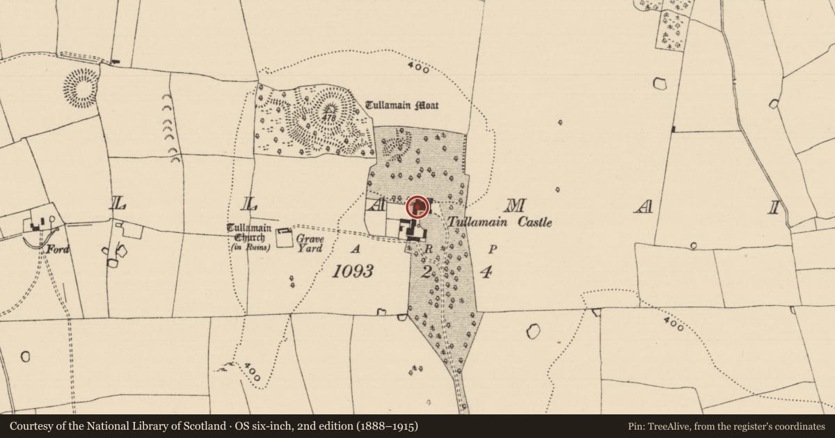
The Civil Survey (1654-6) refers to 'a thatcht house' in 'Tullaghmaine' which was in 1640 under the proprietorship of 'Richard Comyn of Tullaghmaine Irish Papist' (Simington 1931, vol. 1, 206). According to Bence-Jones (1988, 277) the present 'castle' is built on the site of an earlier house. The present 'castle' was designed by William Tinsley and built between 1835 and 1838 (ibid.). The 'castle' was burnt in the 1920s and subsequently rebuilt (Craig and Garner 1975, 104).
Compiled by: Jean Farrelly
Date of upload: 26 August 2011
References
Craig, M. and Garner, W. 1975 National heritage inventory of buildings of architectural, historic and artistic interest in County Tipperary - South Riding. A preliminary survey. An Foras Forbartha Teoranta. Unpublished.
Bence-Jones, M. 1988 A guide to Irish country houses. London
Simington, R.C. (ed.) 1931 The Civil survey, AD 1654-1656. Vol I: county of Tipperary: eastern and southern baronies. Dublin. Irish Manuscripts Commission.
Nearby in the register
- Castle - unclassifiedunder 1 mi
- Castle - motte and baileyunder 1 mi
- Graveslabunder 1 mi
- Graveslabunder 1 mi
Other entries of the same register within about three miles of this one, by straight line.