Sites and Monuments Record · Ireland
Barrow - ring-barrow
Ballynagleragh, County Tipperary South, Ireland
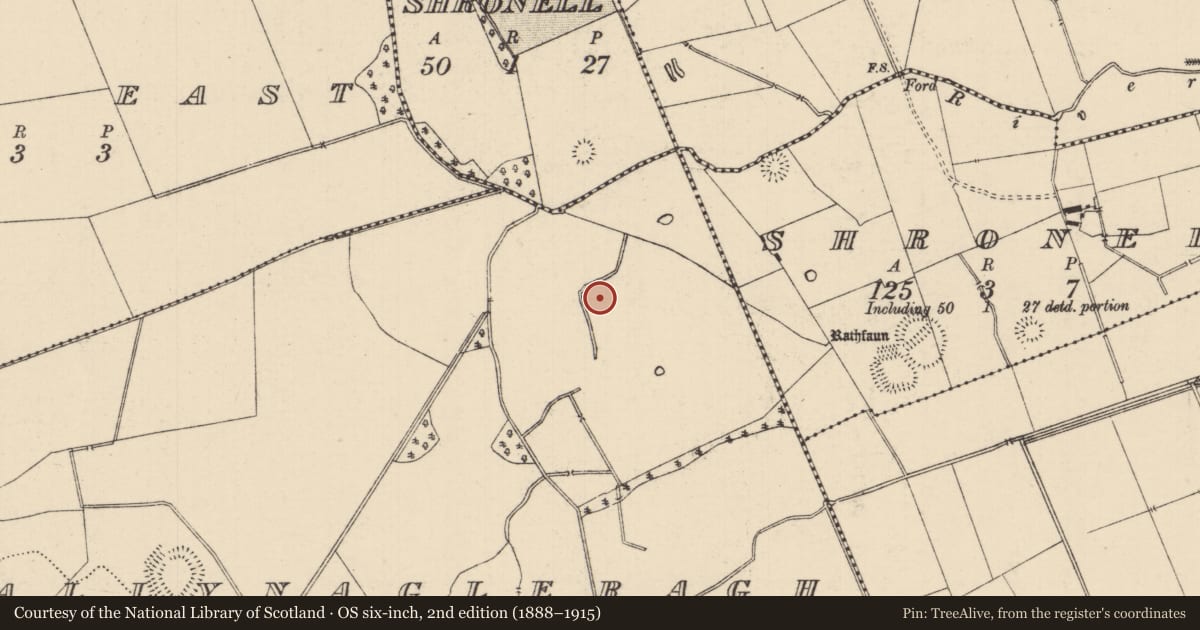
The record
- Townland
- Ballynagleragh
- County
- Tipperary South
- Country
- Ireland
- First-edition OS map
- Not indicated
- Latest-edition OS map
- Not indicated
- Coordinates
- 52.46204, -8.25191
- SMR number
- TS066-227----
Slide toward Today to fade the historical sheet and see the modern map underneath.
David Rumsey Map Collection, Stanford LibrariesDavid Rumsey Map Collection, Stanford LibrariesDavid Rumsey Map Collection, Stanford LibrariesDavid Rumsey Map Collection, Stanford Libraries
4 historical maps cover this location, the earliest the 1790 map "Composite: Ireland." (David Rumsey Map Collection, Stanford Libraries).
Historical maps covering this location
- 1790 · Composite: Ireland. (David Rumsey Map Collection, Stanford Libraries)
- 1882 · Ireland (southern half). (David Rumsey Map Collection, Stanford Libraries)
- 1891 · Ireland 16 (David Rumsey Map Collection, Stanford Libraries)
- 1904 · Sheet 13. (David Rumsey Map Collection, Stanford Libraries)
This record in the National Monuments Service's Historic Environment Viewer ↗
The National Monuments Service's description
In a valley, on top of a low natural rise, in gently undulating hummocky wet terrain, in pasture. A field boundary incorporating a stream runs roughly NW-SE 25m to the W. The view is generally good along the valley floor and also to the S of the N slopes of a hill range, including Moanour Mountain, Slievenamuck, Carrigeenina and The Steeple. A circular enclosure visible on satellite imagery (Google Earth satellite imagery, 18 November 2018), identified and reported by Jean-Charles Caillère. A low circular flat-topped mound (diam. 7.3m; H 0.15m) enclosed by a shallow fosse (Wth 1.8m; D 0.1m) and slight traces of an outer bank (Wth 1.7-2.2m; ext. H 0.1m). Another ring-barrow (TS066-226----) is located 4m to the WNW and a possible ditch barrow (TS066-228----) c. 90m to the SE.
See attached:
TS066-227----_01 Google Earth image (imagery date 18 November 2018)
TS066-227----_02 Overview from the S
TS066-227----_03 Overview from the S with neighbouring ring-barrow TS066-226---- in the background
Compiled by: Jean Farrelly
Date of upload: 14 January 2022
Nearby in the register
- Barrow - ring-barrowunder 1 mi
- Barrow - ditch barrowunder 1 mi
- Enclosureunder 1 mi
- Ringfort - rathunder 1 mi
Other entries of the same register within about three miles of this one, by straight line.