Sites and Monuments Record · Ireland
Bawn
Slainstown North, County Tipperary South, Ireland
The record
- Townland
- Slainstown North
- County
- Tipperary South
- Country
- Ireland
- First-edition OS map
- Not indicated
- Latest-edition OS map
- Not indicated
- Coordinates
- 52.49689, -7.67649
- SMR number
- TS062-122003-
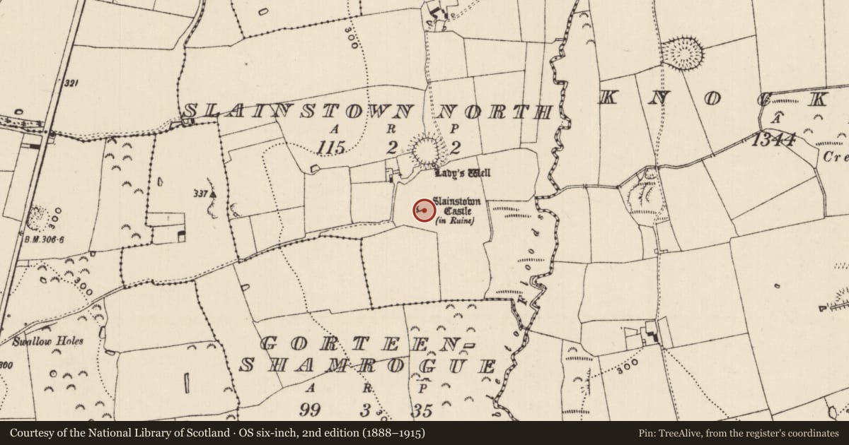
Slide toward Today to fade the historical sheet and see the modern map underneath.
David Rumsey Map Collection, Stanford LibrariesDavid Rumsey Map Collection, Stanford LibrariesDavid Rumsey Map Collection, Stanford LibrariesDavid Rumsey Map Collection, Stanford Libraries
4 historical maps cover this location, the earliest the 1790 map "Composite: Ireland." (David Rumsey Map Collection, Stanford Libraries).
Historical maps covering this location
- 1790 · Composite: Ireland. (David Rumsey Map Collection, Stanford Libraries)
- 1882 · Ireland (southern half). (David Rumsey Map Collection, Stanford Libraries)
- 1891 · Ireland 16 (David Rumsey Map Collection, Stanford Libraries)
- 1904 · Sheet 13. (David Rumsey Map Collection, Stanford Libraries)
This record in the National Monuments Service's Historic Environment Viewer ↗
The National Monuments Service's description
On a flat-topped ridge running N-S in undulating terrain, under pasture. Ground drops away to E and S beyond bawn. Bawn (dims. c. 140m N-S x 124m E-W) encloses a tower house with adjoining later 17th-century house. Only a short wall length survives (L 1.8m; T 0.76m; H 1.6m) at the E end of the W side, composed of limestone rubble, roughly coursed with a thick pebbley mortar. Otherwise the bawn is defined by a low bank (Wth 1.6-4m; int. H 0.2m; ext. H 0.4-0.78m) which is reduced to scarp along the E side (H 0.86m) and least well defined along the S side where a stream and field boundary run along outer edge of poorly defined bank. Along the N side there is an external fosse (Wth 6.2m; D 1.37m) which was waterlogged at time of inspection, this fosse may be related to a field boundary which runs E-W parallel to the N bank of the bawn. There are undulations within the bawn E and W of the tower house and house.
Compiled by: Jean Farrelly
Date of upload: 26 August 2011
Nearby in the register
- House - 17th centuryunder 1 mi
- Castle - tower houseunder 1 mi
- Ritual site - holy wellunder 1 mi
- Ringfort - rathunder 1 mi
Other entries of the same register within about three miles of this one, by straight line.