Sites and Monuments Record · Ireland
Gateway (present location)
Peppardstown, County Tipperary South, Ireland
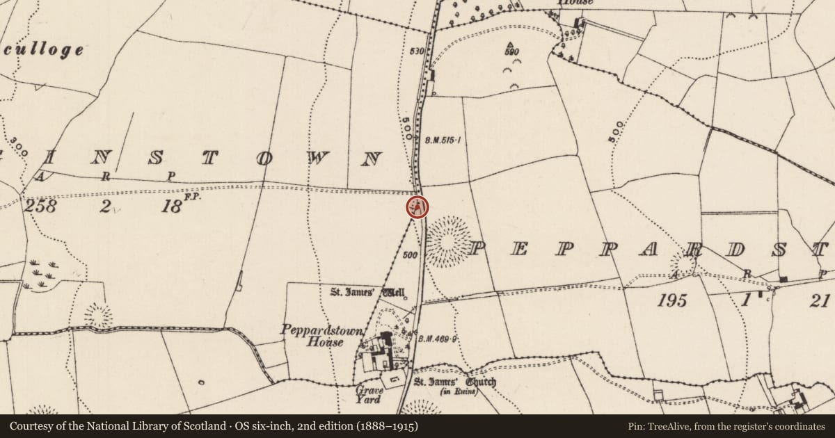
The record
- Townland
- Peppardstown
- County
- Tipperary South
- Country
- Ireland
- First-edition OS map
- Not indicated
- Latest-edition OS map
- Not indicated
- Coordinates
- 52.51000, -7.65215
- SMR number
- TS062-087----
Slide toward Today to fade the historical sheet and see the modern map underneath.
David Rumsey Map Collection, Stanford LibrariesDavid Rumsey Map Collection, Stanford LibrariesDavid Rumsey Map Collection, Stanford LibrariesDavid Rumsey Map Collection, Stanford Libraries
4 historical maps cover this location, the earliest the 1790 map "Composite: Ireland." (David Rumsey Map Collection, Stanford Libraries).
Historical maps covering this location
- 1790 · Composite: Ireland. (David Rumsey Map Collection, Stanford Libraries)
- 1882 · Ireland (southern half). (David Rumsey Map Collection, Stanford Libraries)
- 1891 · Ireland 16 (David Rumsey Map Collection, Stanford Libraries)
- 1904 · Sheet 13. (David Rumsey Map Collection, Stanford Libraries)
This record in the National Monuments Service's Historic Environment Viewer ↗
The National Monuments Service's description
In improved pasture, on the W side of a tertiary road, on a W-facing slope. A semi-circular arched gateway (dims. Wth 2.29m; H 3.3m; D 0.88m) defined by well-cut limestone jambs and voussoirs (H at W-end 2.92m; H at E-end 1.84m) with punch dressing on all visible surfaces and a long jamb on the W side has a plain margin with two rows of punch tooling and slightly cruder punch dressing within this border. Both sides have curvilinear hanging eyes of cut and dressed stone and squared spud stones, which appear to be in situ. A pair of double leaf, wrought iron gates are currently utilising both the spuds and hanging eyes.The threshold, consisting of a large rectangular roughly cut stone and some smaller stones, is roughly level with the ground on the N side but is raised above the ground on the S side where it rests on several courses of walling. The gateway is within a wall (dims. L 8.51m; H 3.55m; T 0.9m) of roughly coursed limestone rubble, at either end of which there are well-cut and dressed quoins. According to local tradition, this gateway which was never used and is contemporary with Peppardstown House which lies c. 300m to the S. The gateway is of 16th/early 17th century date and is likely to have been originally incorporated in a bawn. The gateway was presumably moved from its origin location and re-erected as an entrance feature for Peppardstown House. Peppardstown House is a multi-period building with the earliest portion to the rear, but this appears to be of 18th century date, with the front portion dating to the 19th century.
Compiled by: Jean Farrelly
Date of upload: 26 August 2011
Nearby in the register
- Ringfort - rathunder 1 mi
- Ritual site - holy wellunder 1 mi
- Graveyardunder 1 mi
- Churchunder 1 mi
Other entries of the same register within about three miles of this one, by straight line.