Sites and Monuments Record · Ireland
Graveslab
Cashel, County Tipperary South, Ireland
The record
- Townland
- Cashel
- County
- Tipperary South
- Country
- Ireland
- First-edition OS map
- Not indicated
- Latest-edition OS map
- Not indicated
- Coordinates
- 52.51516, -7.88588
- SMR number
- TS061-025155-
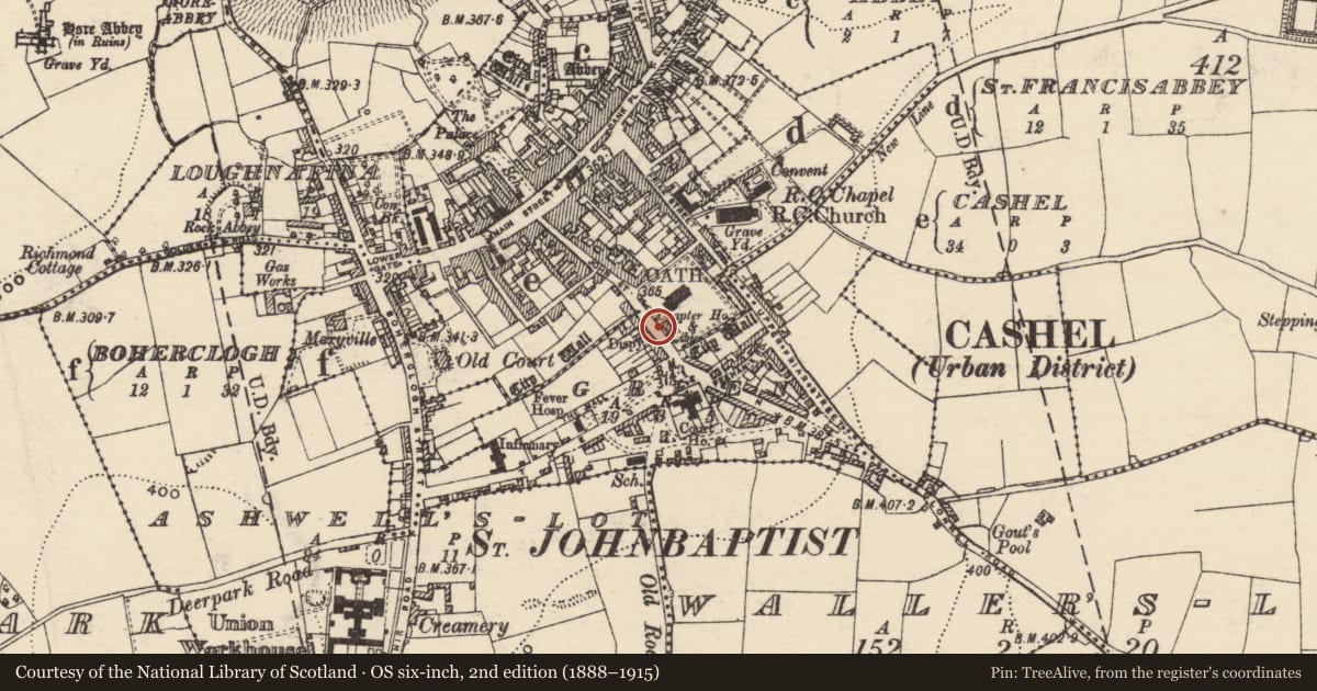
Slide toward Today to fade the historical sheet and see the modern map underneath.
David Rumsey Map Collection, Stanford LibrariesDavid Rumsey Map Collection, Stanford LibrariesDavid Rumsey Map Collection, Stanford LibrariesDavid Rumsey Map Collection, Stanford Libraries
4 historical maps cover this location, the earliest the 1790 map "Composite: Ireland." (David Rumsey Map Collection, Stanford Libraries).
Historical maps covering this location
- 1790 · Composite: Ireland. (David Rumsey Map Collection, Stanford Libraries)
- 1882 · Ireland (southern half). (David Rumsey Map Collection, Stanford Libraries)
- 1891 · Ireland 16 (David Rumsey Map Collection, Stanford Libraries)
- 1904 · Sheet 13. (David Rumsey Map Collection, Stanford Libraries)
This record in the National Monuments Service's Historic Environment Viewer ↗
The National Monuments Service's description
Lying recumbent W of the entrance to the Bolton library which is in the grounds of the graveyard (TS061-025035-) of the medieval church (TS061-025013-), the later replaced by St John's C of I Cathedral. A rectangular limestone slab (L 1.99m; Wth 0.79m) with a horizontal break across the face c. 1.5m from the top. Though no 17th-centuy inscription is visible, an incised inscription in Roman script south of the centre of the slab reads: HIC JACET CORPUS / REV IN CHRISTO PATRIS THOMAE PRICE / NUP CASSEL ARCHIEP/ QUI OBIIT / PRID NON AUG 1685 / AET 85 and at the bottom of the slab, on the sinister side, is inscribed 'RESCRIPT 1875'. Under this date another date '1965' has been added.
Compiled by: Jean Farrelly
Date of upload: 25 July 2012
Nearby in the register
- Wall monumentunder 1 mi
- Sheela-na-gig (present location)under 1 mi
- Graveslabunder 1 mi
- Graveslabunder 1 mi
Other entries of the same register within about three miles of this one, by straight line.