Sites and Monuments Record · Ireland
Enclosure
Ballinamona (Oughterleague Par.), County Tipperary South, Ireland
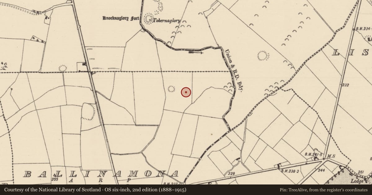
The record
- Townland
- Ballinamona (Oughterleague Par.)
- County
- Tipperary South
- Country
- Ireland
- First-edition OS map
- Not indicated
- Latest-edition OS map
- Not indicated
- Coordinates
- 52.52757, -7.99290
- SMR number
- TS060-134----
Slide toward Today to fade the historical sheet and see the modern map underneath.
David Rumsey Map Collection, Stanford LibrariesDavid Rumsey Map Collection, Stanford LibrariesDavid Rumsey Map Collection, Stanford LibrariesDavid Rumsey Map Collection, Stanford Libraries
4 historical maps cover this location, the earliest the 1790 map "Composite: Ireland." (David Rumsey Map Collection, Stanford Libraries).
Historical maps covering this location
- 1790 · Composite: Ireland. (David Rumsey Map Collection, Stanford Libraries)
- 1882 · Ireland (southern half). (David Rumsey Map Collection, Stanford Libraries)
- 1891 · Ireland 16 (David Rumsey Map Collection, Stanford Libraries)
- 1904 · Sheet 13. (David Rumsey Map Collection, Stanford Libraries)
This record in the National Monuments Service's Historic Environment Viewer ↗
The National Monuments Service's description
In poorly drained, generally level pasture. Monument identified on an aerial photograph (ASIAP (312)26 13/09/02). Enclosure (TS060-045----) is c. 34m to W. Sub-circular area (dims. 18m NNW-SSE; 16m ENE-WSW) defined by scarp (Wth 1.5m; H 0.45m) which has been straightened across WSW-sector due to linear drain on this side and also along N-sector, where fosse re-cut as drain. Possible entrance (overall Wth 5.5m; basal Wth 3m) at SE where it is cut into interior ground level and covered in yellow flags. Fosse (overall Wth 5.1m; basal Wth 2.5m; D 0.2m) is best preserved NE-ESE and possibly at SW where it appears unmodified. Fosse traceable ESE-SW and straightened and backfilled across WSW-sector and straightened and re-cut across N-sector. Fosse obscured NW-N by dense briars encroaching onto scarp. Interior has a gentle depression within from where ground slopes upwards to upper edge of scarp.
Compiled by: Jean Farrelly
Date of upload: 26 August 2011
Nearby in the register
- Enclosureunder 1 mi
- Ritual site - holy wellunder 1 mi
- Enclosureunder 1 mi
- Enclosureunder 1 mi
Other entries of the same register within about three miles of this one, by straight line.