Sites and Monuments Record · Ireland
Enclosure
Shanballyduff (Dangandargan Par.), County Tipperary South, Ireland
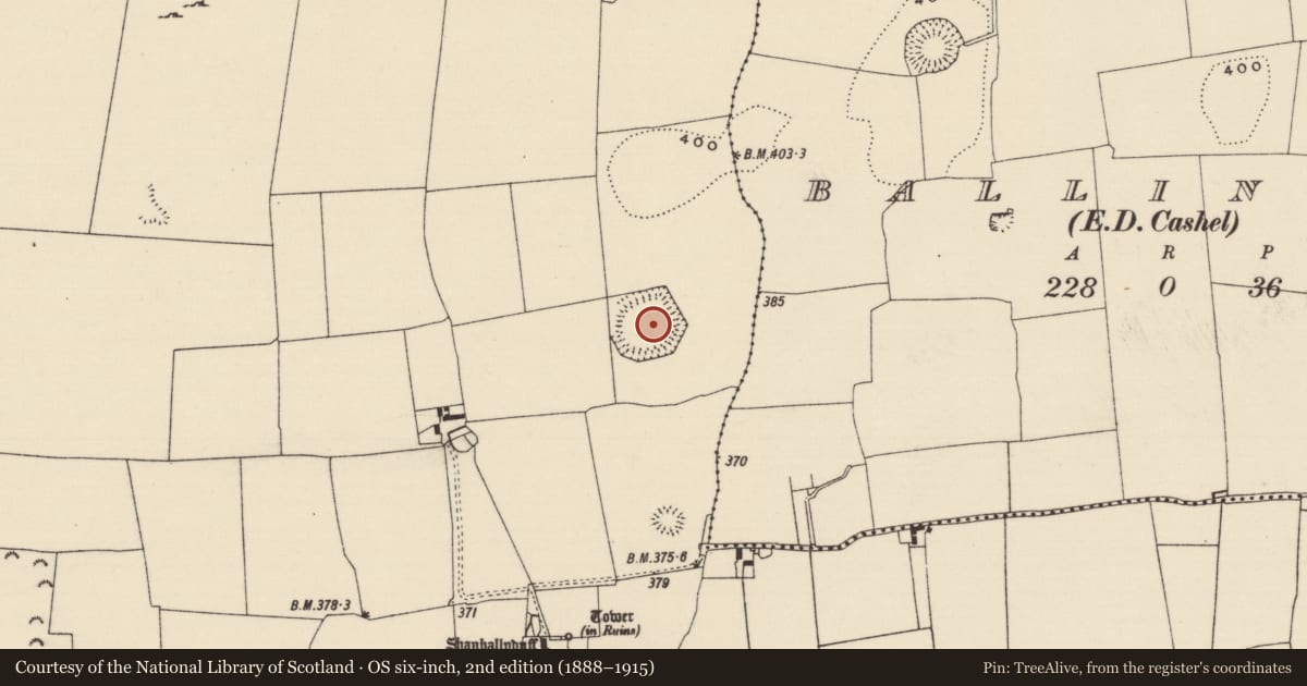
The record
- Townland
- Shanballyduff (Dangandargan Par.)
- County
- Tipperary South
- Country
- Ireland
- First-edition OS map
- Hachured
- Latest-edition OS map
- Hachured
- Coordinates
- 52.49106, -7.91782
- SMR number
- TS060-112----
Slide toward Today to fade the historical sheet and see the modern map underneath.
David Rumsey Map Collection, Stanford LibrariesDavid Rumsey Map Collection, Stanford LibrariesDavid Rumsey Map Collection, Stanford LibrariesDavid Rumsey Map Collection, Stanford Libraries
4 historical maps cover this location, the earliest the 1790 map "Composite: Ireland." (David Rumsey Map Collection, Stanford Libraries).
Historical maps covering this location
- 1790 · Composite: Ireland. (David Rumsey Map Collection, Stanford Libraries)
- 1882 · Ireland (southern half). (David Rumsey Map Collection, Stanford Libraries)
- 1891 · Ireland 16 (David Rumsey Map Collection, Stanford Libraries)
- 1904 · Sheet 13. (David Rumsey Map Collection, Stanford Libraries)
This record in the National Monuments Service's Historic Environment Viewer ↗
The National Monuments Service's description
In tillage, on a generally level area. Surrounding land is gently undulating. Sub-oval area (dims. 70m NE-SW; 63m NW-SE) defined by remains of earthen bank (Wth 6-8m; int. H 0.3-0.4m; ext. H min. 0.45 - max. 1.15m). Bank is only accessible in a few places and is otherwise covered in thorn trees which are choked on either side by briars and nettles. Interior is covered in dense grasses and thistles and tall cow parsley and has not been grazed or cut in years. Area of interior to E side is high and appears to be an enclosure (TS060-112001-). Depicted on latest edition OS 6-inch map as having a straight side to ENE, however this was not seen due to overgrowth. Field boundary also depicted enclosing monument, however this has been levelled, where seen NW-WSW, and has been merged with exterior of enclosure bank. The presence of an internal enclosure suggests that this monument, together with the internal feature, may be a concentric enclosure.
Compiled by: Jean Farrelly
Date of revised upload: 28 October 2015
Nearby in the register
- Enclosureunder 1 mi
- Ringfort - rathunder 1 mi
- Bawnunder 1 mi
- Castle - tower houseunder 1 mi
Other entries of the same register within about three miles of this one, by straight line.