Sites and Monuments Record · Ireland
House - 17th century
Lisheen (Ballygriffin Par.), County Tipperary South, Ireland
The record
- Townland
- Lisheen (Ballygriffin Par.)
- County
- Tipperary South
- Country
- Ireland
- First-edition OS map
- Lisheen Ho.
- Latest-edition OS map
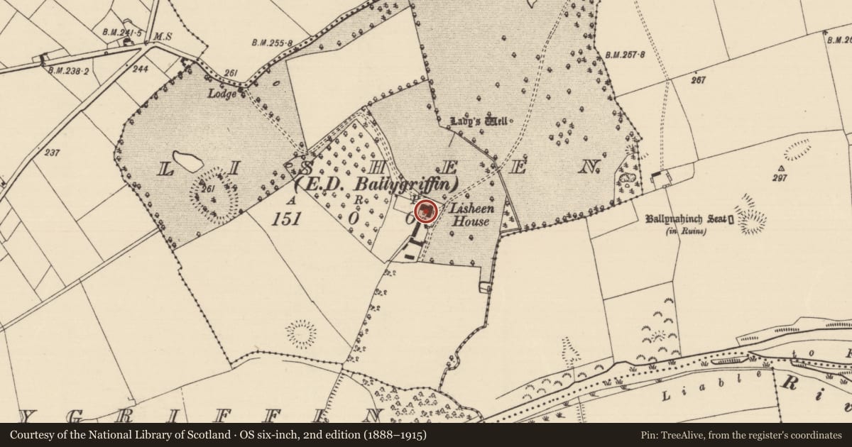
- Lisheen House
- Coordinates
- 52.52165, -7.97489
- SMR number
- TS060-055----
Slide toward Today to fade the historical sheet and see the modern map underneath.
David Rumsey Map Collection, Stanford LibrariesDavid Rumsey Map Collection, Stanford LibrariesDavid Rumsey Map Collection, Stanford LibrariesDavid Rumsey Map Collection, Stanford Libraries
4 historical maps cover this location, the earliest the 1790 map "Composite: Ireland." (David Rumsey Map Collection, Stanford Libraries).
Historical maps covering this location
- 1790 · Composite: Ireland. (David Rumsey Map Collection, Stanford Libraries)
- 1882 · Ireland (southern half). (David Rumsey Map Collection, Stanford Libraries)
- 1891 · Ireland 16 (David Rumsey Map Collection, Stanford Libraries)
- 1904 · Sheet 13. (David Rumsey Map Collection, Stanford Libraries)
This record in the National Monuments Service's Historic Environment Viewer ↗
The National Monuments Service's description
According to the Civil Survey (1654-6) in 1640 there was 'a good thatcht house with stone walls' in 'Lissin Irea' and 'Theobald Bourke of Lissin Irea Irish Papist' is listed as the proprietor (Simington 1934, vol. 2, 9). This house may have been incorporated into Lisheen House which is now demolished and a bungalow has been built on the site. A 19th-century drawing of Lisheen House shows that it was a late Georgian style five-bay, three-storey over basement house with two central chimney stacks and a hipped, overhanging roof. A building is show at a right angle to the rear of the house but it is not possible to ascertain whether this is a two-storey return or a separate outbuilding. In the 19th century this was the seat of Sir J. J. Fitzgerald, Baronet (Lewis 1837, 135).
Compiled by: Jean Farrelly
Date of upload: 26 August 2011
References
Simington, R.C. (ed.) 1934 The Civil survey, AD 1654-1656. Vol. II: county of Tipperary - Western and Northern baronies. Dublin. Irish Manuscripts Commission.
Lewis, S. 1837 A topographical dictionary of Ireland, 2 vols. London. Lewis and Co.
Nearby in the register
- Enclosureunder 1 mi
- Ritual site - holy wellunder 1 mi
- Enclosureunder 1 mi
- Enclosureunder 1 mi
Other entries of the same register within about three miles of this one, by straight line.