Sites and Monuments Record · Ireland
Children's burial ground
Camus (St. Patricksrock Par.), County Tipperary South, Ireland
The record
- Townland
- Camus (St. Patricksrock Par.)
- County
- Tipperary South
- Country
- Ireland
- First-edition OS map
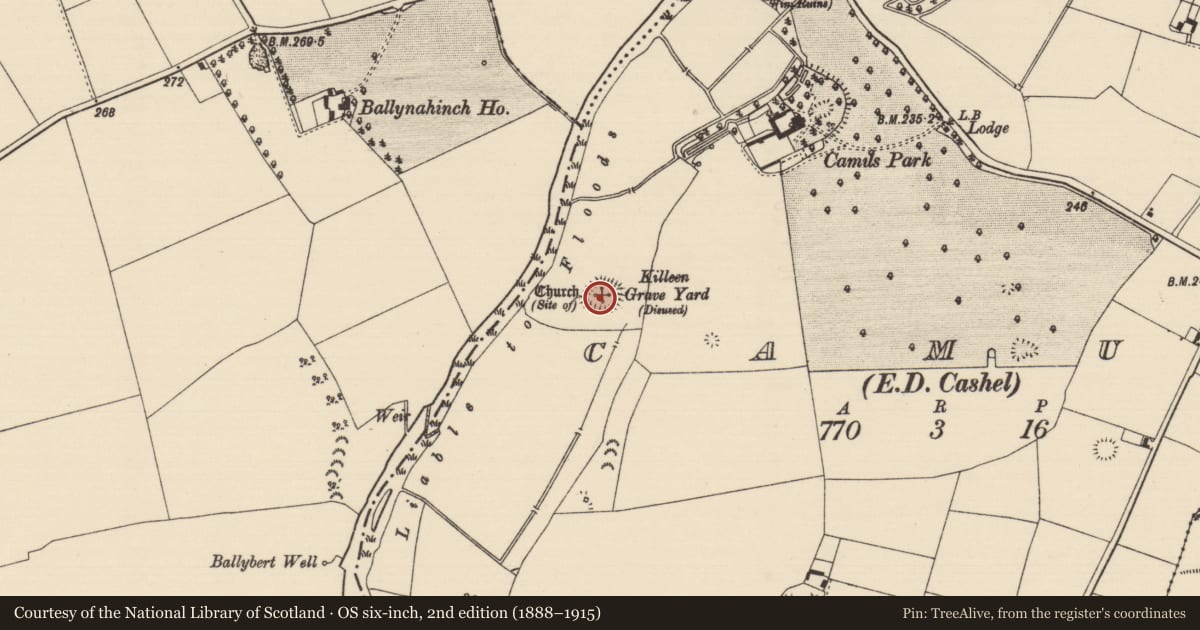
- Killeen Grave Yard
- Latest-edition OS map
- Killeen Grave Yard (Disused)
- Coordinates
- 52.53463, -7.93624
- SMR number
- TS060-030002-
Slide toward Today to fade the historical sheet and see the modern map underneath.
David Rumsey Map Collection, Stanford LibrariesDavid Rumsey Map Collection, Stanford LibrariesDavid Rumsey Map Collection, Stanford LibrariesDavid Rumsey Map Collection, Stanford Libraries
4 historical maps cover this location, the earliest the 1790 map "Composite: Ireland." (David Rumsey Map Collection, Stanford Libraries).
Historical maps covering this location
- 1790 · Composite: Ireland. (David Rumsey Map Collection, Stanford Libraries)
- 1882 · Ireland (southern half). (David Rumsey Map Collection, Stanford Libraries)
- 1891 · Ireland 16 (David Rumsey Map Collection, Stanford Libraries)
- 1904 · Sheet 13. (David Rumsey Map Collection, Stanford Libraries)
This record in the National Monuments Service's Historic Environment Viewer ↗
The National Monuments Service's description
In improved pasture, in highest part of field, at terminus of broad ridge (general long axis NNE-SSW). Flood plain of River Suir in field to N and W. No visible surface trace. According to OSL (Vol. 1, 314), the graveyard (TS060-030003-) was no longer in use except for the internment of children. John Davis White (1892, 16) confirms that 'at no distant period, unbaptized infants have been buried here.' Named 'Killeen' on latest edition OS 6-inch map. According to Meskell (2003, 16) land reclamation work in the mid 1980s removed all traces of the graveyard. At the time of the reclamation quantities of stone and human bones were uncovered (ibid.). According to local information this graveyard had been used as a burial ground for unbaptised children up to c. 1920 (ibid.).
Compiled by: Jean Farrelly
Date of upload: 22 July 2014
References
Meskell, P. 2003 Killeen Graveyard, Camus. Boherlahan-Dualla Historical Journal, 15-16. Boherlahan-Dualla Historical Journal Society.
Nearby in the register
- Graveyardunder 1 mi
- Churchunder 1 mi
- Castle - unclassifiedunder 1 mi
- Road - road/trackwayunder 1 mi
Other entries of the same register within about three miles of this one, by straight line.