Sites and Monuments Record · Ireland
Castle - unclassified
Solloghodbeg, County Tipperary South, Ireland
The record
- Townland
- Solloghodbeg
- County
- Tipperary South
- Country
- Ireland
- First-edition OS map
- Not indicated
- Latest-edition OS map
- Not indicated
- Coordinates
- 52.51140, -8.16280
- SMR number
- TS059-065----
Slide toward Today to fade the historical sheet and see the modern map underneath.
David Rumsey Map Collection, Stanford LibrariesDavid Rumsey Map Collection, Stanford LibrariesDavid Rumsey Map Collection, Stanford LibrariesDavid Rumsey Map Collection, Stanford Libraries
4 historical maps cover this location, the earliest the 1790 map "Composite: Ireland." (David Rumsey Map Collection, Stanford Libraries).
Historical maps covering this location
- 1790 · Composite: Ireland. (David Rumsey Map Collection, Stanford Libraries)
- 1882 · Ireland (southern half). (David Rumsey Map Collection, Stanford Libraries)
- 1891 · Ireland 16 (David Rumsey Map Collection, Stanford Libraries)
- 1904 · Sheet 13. (David Rumsey Map Collection, Stanford Libraries)
This record in the National Monuments Service's Historic Environment Viewer ↗
The National Monuments Service's description
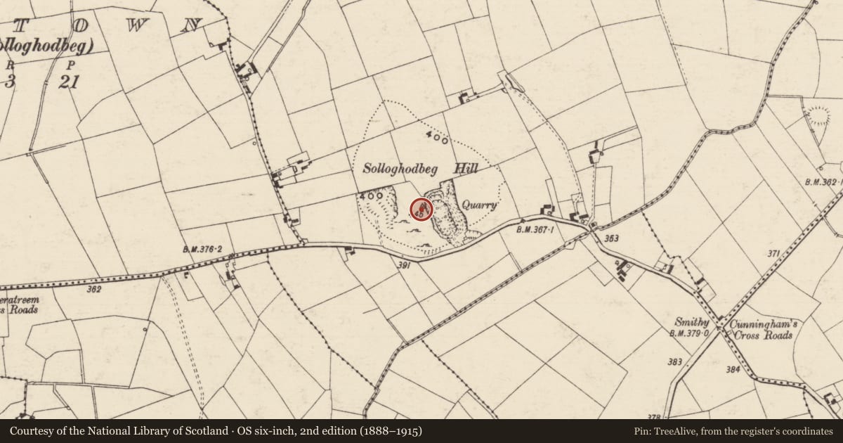
In improved pasture, on top of a hill, with panoramic views. There is a deep quarry to the E. A trigonometric point marks the peak of Solloghodbeg Hill to the W. The castle is not visible at ground level. According to the Civil Survey of 1640, 'on the top of Sollaghodbegg hill stands the stumpe of a castle Irepayreable' (Simington 1934, vol. 2, 54). A curvilinear hachured feature depicted on the 1904 edition OS 6-inch map may be associated with the castle, however, the area has been quarried. A level, grassed-over track (Wth c. 2m) has been cut into the contour of the hill on the W side, with a ramp leading up into the pasture field where the monument is located, it is probably a quarry road. A deep, wide fosse and high earthen bank downslope to the W of the track may also be associated with quarrying activities.
Compiled by: Jean Farrelly
Date of upload: 26 August 2011
References
Simington, R.C. (ed.) 1934 The Civil survey, AD 1654-1656. Vol. II: county of Tipperary - Western and Northern baronies. Dublin. Irish Manuscripts Commission.
Nearby in the register
- Enclosureunder 1 mi
- Enclosureunder 1 mi
- Enclosureunder 1 mi
- Ringfort - rathunder 1 mi
Other entries of the same register within about three miles of this one, by straight line.