Sites and Monuments Record · Ireland
Moated site
Donaskeagh, County Tipperary South, Ireland
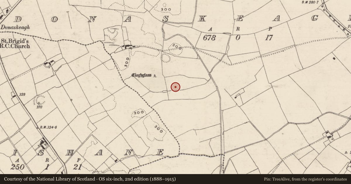
The record
- Townland
- Donaskeagh
- County
- Tipperary South
- Country
- Ireland
- First-edition OS map
- Not indicated
- Latest-edition OS map
- Not indicated
- Coordinates
- 52.51916, -8.06962
- SMR number
- TS059-059----
Slide toward Today to fade the historical sheet and see the modern map underneath.
David Rumsey Map Collection, Stanford LibrariesDavid Rumsey Map Collection, Stanford LibrariesDavid Rumsey Map Collection, Stanford LibrariesDavid Rumsey Map Collection, Stanford Libraries
4 historical maps cover this location, the earliest the 1790 map "Composite: Ireland." (David Rumsey Map Collection, Stanford Libraries).
Historical maps covering this location
- 1790 · Composite: Ireland. (David Rumsey Map Collection, Stanford Libraries)
- 1882 · Ireland (southern half). (David Rumsey Map Collection, Stanford Libraries)
- 1891 · Ireland 16 (David Rumsey Map Collection, Stanford Libraries)
- 1904 · Sheet 13. (David Rumsey Map Collection, Stanford Libraries)
This record in the National Monuments Service's Historic Environment Viewer ↗
The National Monuments Service's description
In wet, level pasture. Monument identified as a rectangular enclosure on an aerial photograph (GSI R.436/5, 16/04/1974). A rectangular area (dims. 16m NNW-SSE; 26m ENE-WSW) defined by scarp (Wth 0.65m; H 0.15m), an intervening fosse (Wth 2.6-3.35m; D 0.2-0.25m), outer bank ((Wth 7.4-7.45m; int. H 0.2-0.25m; ext. H 0.5-0.6m) and outer fosse (Wth 6.45-6.6m; D 0.15-0.2m) which has been modified where a linear land drain (long axis E-W) is incorporated along the S side. The scarp is best preserved from SE-NW and is reduced to a very low scarp (Wth 0.5m; H 0.05m) from NW-SE. The fosse is best defined from the SSW-WSW. The outer bank (Wth 7.4-7.45m; int. H 0.2-0.25m; ext. H 0.5-0.6m) (L 34m at N; 23m at E; 28m at S; 19m at W) has rounded corners. There is a causeway (Wth 2m) at the SW angle and a possible entrance (Wth 3.5m) at the E end of the N side. The grass-covered interior is uneven, with occasional rushes. There is a possible house site (TS059-059001-) within the SW quadrant. A standing stone (TS059-058----) lies c. 90m to the NW and there is an enclosure (TS059-057----) c. 100m to the NNW.
Compiled by: Jean Farrelly
Date of upload: 26 August 2011
Nearby in the register
- House - indeterminate dateunder 1 mi
- Barrow - ring-barrowunder 1 mi
- Standing stoneunder 1 mi
- Enclosureunder 1 mi
Other entries of the same register within about three miles of this one, by straight line.