Sites and Monuments Record · Ireland
Castle - ringwork and bailey
Ballydonagh,Ranacrohy (Kilmucklin Par.), County Tipperary South, Ireland
The record
- Townland
- Ballydonagh,Ranacrohy (Kilmucklin Par.)
- County
- Tipperary South
- Country
- Ireland
- First-edition OS map
- Shanbally fort
- Latest-edition OS map
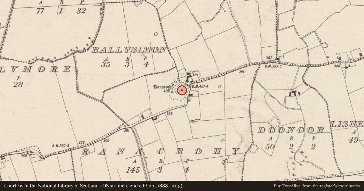
- Ranacrohy
- Coordinates
- 52.51531, -8.12921
- SMR number
- TS059-049----
Slide toward Today to fade the historical sheet and see the modern map underneath.
David Rumsey Map Collection, Stanford LibrariesDavid Rumsey Map Collection, Stanford LibrariesDavid Rumsey Map Collection, Stanford LibrariesDavid Rumsey Map Collection, Stanford Libraries
4 historical maps cover this location, the earliest the 1790 map "Composite: Ireland." (David Rumsey Map Collection, Stanford Libraries).
Historical maps covering this location
- 1790 · Composite: Ireland. (David Rumsey Map Collection, Stanford Libraries)
- 1882 · Ireland (southern half). (David Rumsey Map Collection, Stanford Libraries)
- 1891 · Ireland 16 (David Rumsey Map Collection, Stanford Libraries)
- 1904 · Sheet 13. (David Rumsey Map Collection, Stanford Libraries)
This record in the National Monuments Service's Historic Environment Viewer ↗
The National Monuments Service's description
In improved pasture, on a hillock with excellent views in all directions. A circular area (map diam. c. 44m) defined by scarp (Wth 3.8m; H 2.1m) N-ESE, SW & NW which is reduced to low scarp (Wth 3.95m; H 1.1m) at E, intervening fosse (Wth 7.8m; D 1.4m) and scant remains of a possible outer bank incorporated in a field boundary (Wth 3.3m; int. H 1.4m; ext. H 0.15m) from SSW-NNW. The monument is enclosed by a townland boundary from NNW-SE. It is named 'Shanbally fort' on the 1840 edition OS 6-inch map and 'Ranacrohy' on the 1904 edition. An adjoining bailey to the SW consists of a sub-rectangular area (dims. 33m ESE-WNW; 23m NNE-SSW) defined by scarp (Wth 2.5-3.5m; H 0.25-0.55m) to S and W and levelled scarp (Wth 0.7m; H 0.2m) to E. A break of slope (Wth 3m) to the S has been utilised as a trackway and is defined by a scarp (L 20m; Wth 3m; H 0.4m) to S. The trackway accesses the interior through a gap at the E end of the S side. There are the remains of a possible bailey fosse (Wth 6.5m; D 0.2m) at the NW which appears to intercept with fosse of ringwork. The interior is generally level and grass covered.
Compiled by: Jean Farrelly
Date of revised upload: 30 November 2016
Nearby in the register
- Enclosureunder 1 mi
- Enclosureunder 1 mi
- Enclosureunder 1 mi
- Barrow - ring-barrowunder 1 mi
Other entries of the same register within about three miles of this one, by straight line.