Sites and Monuments Record · Ireland
Enclosure
Ballyrobin (Kilcornan Par.), County Tipperary South, Ireland
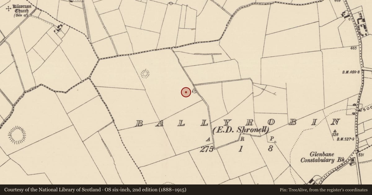
The record
- Townland
- Ballyrobin (Kilcornan Par.)
- County
- Tipperary South
- Country
- Ireland
- First-edition OS map
- Not indicated
- Latest-edition OS map
- Indicated
- Coordinates
- 52.49444, -8.29399
- SMR number
- TS058-042005-
Slide toward Today to fade the historical sheet and see the modern map underneath.
David Rumsey Map Collection, Stanford LibrariesDavid Rumsey Map Collection, Stanford LibrariesDavid Rumsey Map Collection, Stanford LibrariesDavid Rumsey Map Collection, Stanford Libraries
4 historical maps cover this location, the earliest the 1790 map "Composite: Ireland." (David Rumsey Map Collection, Stanford Libraries).
Historical maps covering this location
- 1790 · Composite: Ireland. (David Rumsey Map Collection, Stanford Libraries)
- 1882 · Ireland (southern half). (David Rumsey Map Collection, Stanford Libraries)
- 1891 · Ireland 16 (David Rumsey Map Collection, Stanford Libraries)
- 1904 · Sheet 13. (David Rumsey Map Collection, Stanford Libraries)
This record in the National Monuments Service's Historic Environment Viewer ↗
The National Monuments Service's description
On level ground at the base of a slight N-facing slope, in low-lying improved pasture. A ring-barrow (TS058-042006-) is located within the enclosure on the S side while the enclosure is at the SE edge of a relic field system (TS058-042001-) with an enclosure and ring-barrow (TS058-042003- and TS058-042004-) located 10m to the NW. Roughly rectangular raised area (dims. 16.5m N-S; 12m E-W) defined by a narrow flat-topped earthen bank (overall Wth 2.8m; Wth at top 0.6-1.1m; int. H 0.15m; ext. H 0.05m). From NNE-NE and SE-SW the bank is absent and the platform defined by a scarp (Wth 1.6m; H 1m). From SE-SW the scarp is overlain by the bank of the ring-barrow located in the interior. The edge of the enclosure has been truncated by a SSE-WNW flowing drain NE-SE. The original entrance is not recognisable. The interior undulates slightly and the S three-quarters are occupied by the ring-barrow.
Compiled by: Jean Farrelly
Date of upload: 26 August 2011
Nearby in the register
- Barrow - ring-barrowunder 1 mi
- Barrow - ditch barrowunder 1 mi
- Platformunder 1 mi
- Enclosureunder 1 mi
Other entries of the same register within about three miles of this one, by straight line.