Sites and Monuments Record · Ireland
Castle - unclassified
Longstone (Kilcornan Par.), County Tipperary South, Ireland
The record
- Townland
- Longstone (Kilcornan Par.)
- County
- Tipperary South
- Country
- Ireland
- First-edition OS map
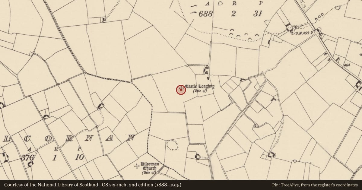
- Site of Castle Loaghny
- Latest-edition OS map
- Castle Loaghny (Site of)
- Coordinates
- 52.50127, -8.30314
- SMR number
- TS058-040----
Slide toward Today to fade the historical sheet and see the modern map underneath.
David Rumsey Map Collection, Stanford LibrariesDavid Rumsey Map Collection, Stanford LibrariesDavid Rumsey Map Collection, Stanford LibrariesDavid Rumsey Map Collection, Stanford Libraries
4 historical maps cover this location, the earliest the 1790 map "Composite: Ireland." (David Rumsey Map Collection, Stanford Libraries).
Historical maps covering this location
- 1790 · Composite: Ireland. (David Rumsey Map Collection, Stanford Libraries)
- 1882 · Ireland (southern half). (David Rumsey Map Collection, Stanford Libraries)
- 1891 · Ireland 16 (David Rumsey Map Collection, Stanford Libraries)
- 1904 · Sheet 13. (David Rumsey Map Collection, Stanford Libraries)
This record in the National Monuments Service's Historic Environment Viewer ↗
The National Monuments Service's description
In grassland on SW-facing slope of rising ground in upland area overlooking low wet marshy land to S and W, higher ground to N. Ringfort (TS058-041----) 270m to S and church and graveyard (TS058-060---- and TS058-060001-) 430m to SW. Not visible at ground level. Long linear feature which may be an old field bank running N and then returns E and appears to enclose the area of the castle may be the wall-footings of a bawn wall running from field boundary to S of castle. Described in the OS letters as 'an old castle called by the people Caislean Lachtnainn(Lochna) - Castleloughnan - but there remains of it at present only a heap of small stones and mortar, all the large stones having been carried away for building houses.' (O'Flanagan 1930, vol. 1, 10).
Compiled by: Jean Farrelly
Date of upload: 26 August 2011
References
O'Flanagan, Rev. M. (Compiler) 1930 Letters containing information relative to the antiquities of the county of Tipperary collected during the progress of the Ordnance Survey in 1840. Bray.
Nearby in the register
- House - early medievalunder 1 mi
- Ringfort - rathunder 1 mi
- House - early medievalunder 1 mi
- Churchunder 1 mi
Other entries of the same register within about three miles of this one, by straight line.