Sites and Monuments Record · Ireland
House - 17th century
Graystown, County Tipperary South, Ireland
The record
- Townland
- Graystown
- County
- Tipperary South
- Country
- Ireland
- First-edition OS map
- Not indicated
- Latest-edition OS map
- Not indicated
- Coordinates
- 52.56525, -7.71604
- SMR number
- TS054-037004-
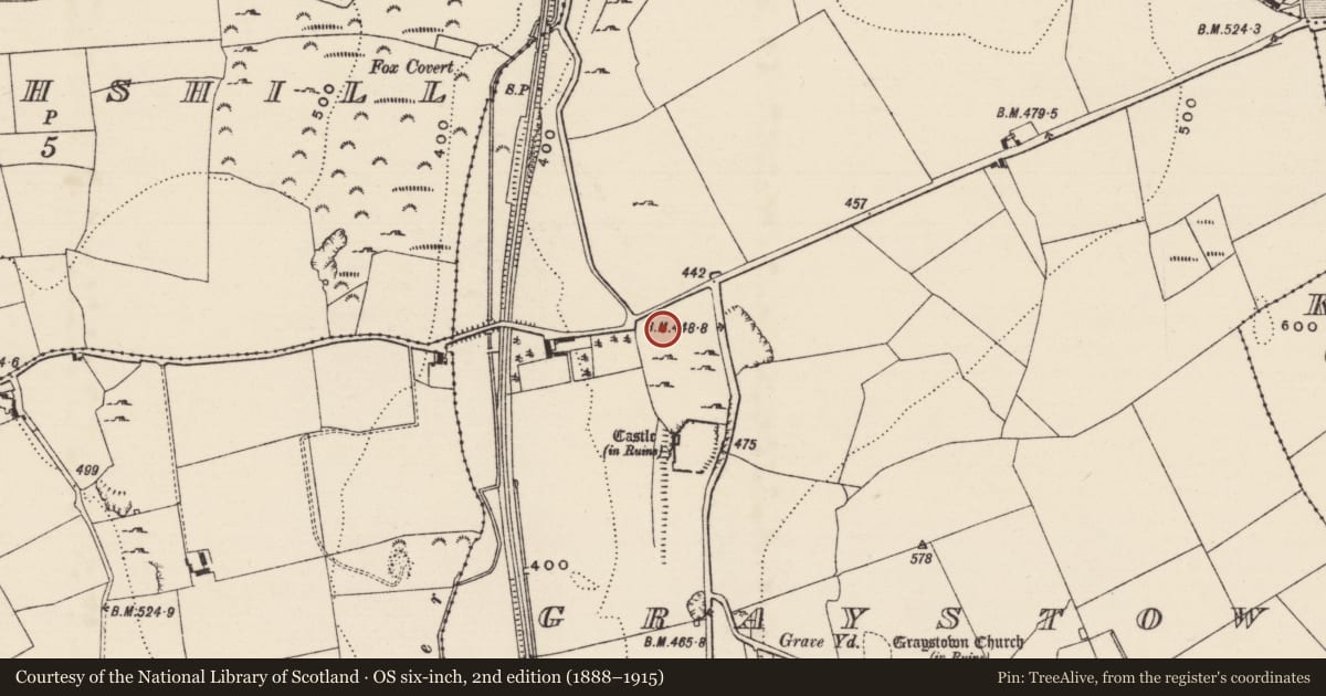
Slide toward Today to fade the historical sheet and see the modern map underneath.
David Rumsey Map Collection, Stanford LibrariesDavid Rumsey Map Collection, Stanford LibrariesDavid Rumsey Map Collection, Stanford LibrariesDavid Rumsey Map Collection, Stanford Libraries
4 historical maps cover this location, the earliest the 1790 map "Composite: Ireland." (David Rumsey Map Collection, Stanford Libraries).
Historical maps covering this location
- 1790 · Composite: Ireland. (David Rumsey Map Collection, Stanford Libraries)
- 1869 · Ireland. (David Rumsey Map Collection, Stanford Libraries)
- 1891 · Ireland 16 (David Rumsey Map Collection, Stanford Libraries)
- 1904 · Sheet 13. (David Rumsey Map Collection, Stanford Libraries)
This record in the National Monuments Service's Historic Environment Viewer ↗
The National Monuments Service's description
Immediately N of the tower house (TS054-037002-), house (TS054-037003-) and bawn (TS054-037001-) there is a rectangular field of rock outcrop which is shown on the first ed. OS 6-inch map as a 'Fair Green'. In this field are the grass-covered wall-footings of at least four possible houses (TS054-037004-; TS054-037005-; TS054-037018- and TS054-037019-) with central road (TS054-037009-) and two enclosures (TS054-037007-; TS054-037008-). Rectangular house (int. dims. 21.50m x 5.85m) at N end of the field, orientated E-W and defined by the grass-covered wall-footings (1.2m; int. H 0.5m; ext. H 0.2m), gap (Wth 1m) in bank at S and a second gap (Wth 1.2m) at N. Evidence of the wall-footings of a cross-wall which divides the long house into two rooms. The larger E room and the smaller W room, the cross-wall is located 15.3m in from the E wall. Immediately to the S of this house there is a smaller house (TS054-037005-). N of this field the fair green continued but was intersected by a modern road running SW-NE. The field to the N appears to be a continuation of the settlement with a castle (TS054-037010-); bawn (TS054-037011-) and two associated buildings (TS054-037-012-; TS054-037013-) and a house (TS054-037014-) and bawn (TS054-037015-) and two associated buildings (TS054-037016-; TS054-037017-).
Compiled by: Jean Farrelly
Date of upload: 26 August 2011
Nearby in the register
- House - 17th centuryunder 1 mi
- Road - road/trackwayunder 1 mi
- Enclosureunder 1 mi
- House - 17th centuryunder 1 mi
Other entries of the same register within about three miles of this one, by straight line.