Sites and Monuments Record · Ireland
Enclosure
Killeen (Killenaule Par.), County Tipperary South, Ireland
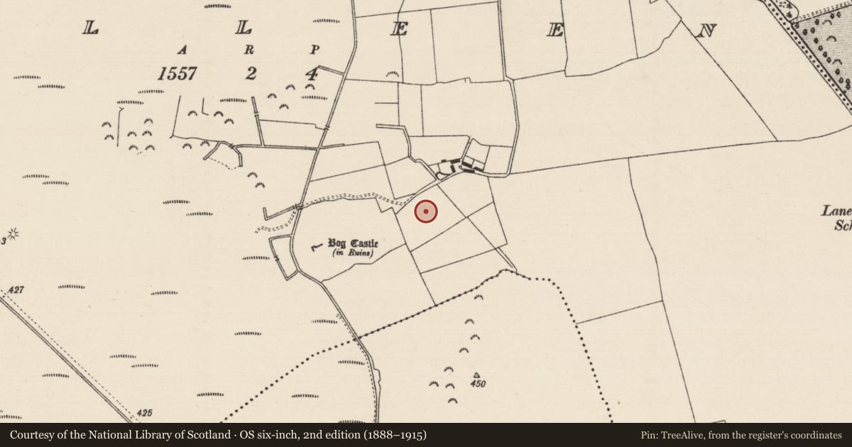
The record
- Townland
- Killeen (Killenaule Par.)
- County
- Tipperary South
- Country
- Ireland
- First-edition OS map
- Not indicated
- Latest-edition OS map
- Not indicated
- Coordinates
- 52.59720, -7.69357
- SMR number
- TS054-004004-
Slide toward Today to fade the historical sheet and see the modern map underneath.
David Rumsey Map Collection, Stanford LibrariesDavid Rumsey Map Collection, Stanford LibrariesDavid Rumsey Map Collection, Stanford LibrariesDavid Rumsey Map Collection, Stanford Libraries
4 historical maps cover this location, the earliest the 1790 map "Composite: Ireland." (David Rumsey Map Collection, Stanford Libraries).
Historical maps covering this location
- 1790 · Composite: Ireland. (David Rumsey Map Collection, Stanford Libraries)
- 1869 · Ireland. (David Rumsey Map Collection, Stanford Libraries)
- 1891 · Ireland 16 (David Rumsey Map Collection, Stanford Libraries)
- 1904 · Sheet 13. (David Rumsey Map Collection, Stanford Libraries)
This record in the National Monuments Service's Historic Environment Viewer ↗
The National Monuments Service's description
On ground sloping very gradually to E in relatively flat reclaimed pasture, formerly wet bogland as the name of the adjacent castle, 'Bog Castle' (TS054-004001-) c. 200m to WSW suggests. Enclosure visible as a raised, roughly rectangualar area on aerial photograph (CUCAP APD 42, APG 55) taken in 1966. Enclosure (dims. 43.5m NW-SE; 55m NE-SW) with a possible annexe to the NE (dims. 43.5m NW-SE; 27m NE-SW) divided from the enclosure by a shallow fosse (Wth 4.6m; D below enclosure 0.4m; D below annexe 0.22m). The enclosure is defined by a scarp (ext. H 0.4-0.7m) which is possibly a fattened bank, and an external fosse (Wth 2m; D above ext. 0.19m) and suggestion of a counterscarp (Wth 2.2m). The NE quadrant of the annexe is not clearly visible, the scarp peters out and the ground becomes very uneven and hummocky. The fosse may have been re-cut to assist drainage as it continues as a ditch to the NE and SW beyond the monument.
Compiled by: Jean Farrelly
Date of upload: 26 August 2011
Nearby in the register
- Settlement deserted - medievalunder 1 mi
- Enclosureunder 1 mi
- Castle - unclassifiedunder 1 mi
- Road - class 1 togherunder 1 mi
Other entries of the same register within about three miles of this one, by straight line.