Sites and Monuments Record · Ireland
Barrow - ditch barrow
Ballysheehan (Ballysheehan Par.), County Tipperary South, Ireland
The record
- Townland
- Ballysheehan (Ballysheehan Par.)
- County
- Tipperary South
- Country
- Ireland
- First-edition OS map
- Not indicated
- Latest-edition OS map
- Not indicated
- Coordinates
- 52.56217, -7.86387
- SMR number
- TS053-042008-
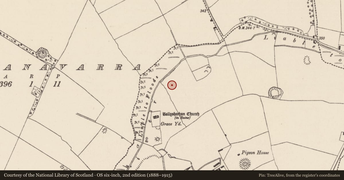
Slide toward Today to fade the historical sheet and see the modern map underneath.
David Rumsey Map Collection, Stanford LibrariesDavid Rumsey Map Collection, Stanford LibrariesDavid Rumsey Map Collection, Stanford LibrariesDavid Rumsey Map Collection, Stanford Libraries
4 historical maps cover this location, the earliest the 1790 map "Composite: Ireland." (David Rumsey Map Collection, Stanford Libraries).
Historical maps covering this location
- 1790 · Composite: Ireland. (David Rumsey Map Collection, Stanford Libraries)
- 1869 · Ireland. (David Rumsey Map Collection, Stanford Libraries)
- 1891 · Ireland 16 (David Rumsey Map Collection, Stanford Libraries)
- 1904 · Sheet 13. (David Rumsey Map Collection, Stanford Libraries)
This record in the National Monuments Service's Historic Environment Viewer ↗
The National Monuments Service's description
In flat grassland. In 1999, during the redevelopment of the stud farm, these earthworks, which possibly represents the remains of a deserted medieval village, were partially buried in topsoil to make the land safe for livestock (Purcell and Gowen 2000, 283). A digital terrain model of the earthworks, prior to this, revealed several features including three circular mounds (diam. 5-6m) which appear as 'shallow ring ditches' and may be barrows or 'residual features from circular feeding troughs' (O'Donovan and Duffy 2002, 39-40). Earthworks to the S which appear on aerial photographs (CUCAP 1967, ATA 64; CUCAP 1971, BGO 11) appear to be the remains of a medieval deserted settlement (TS053-042003-).
Compiled by: Jean Farrelly
Date of upload: 26 August 2011
References
Purcell, A. and Gowen, M. 2000 Ballysheehan Stud, Ballysheehan: Possible deserted medieval village. I.Bennett (ed.), Excavations 1999: summary accounts of archaeological excavations in Ireland, 283. Wordwell. Dublin.
O'Donovan, E. and Duffy, S. 2002 A deserted medieval village at Ballysheehan, Co. Tipperary. Tipperary Historical Journal, 33-43.
Nearby in the register
- Barrow - ditch barrowunder 1 mi
- Barrow - ditch barrowunder 1 mi
- Settlement deserted - medievalunder 1 mi
- Churchunder 1 mi
Other entries of the same register within about three miles of this one, by straight line.