Sites and Monuments Record · Ireland
Castle - motte and bailey
Ballysheehan (Ballysheehan Par.), County Tipperary South, Ireland
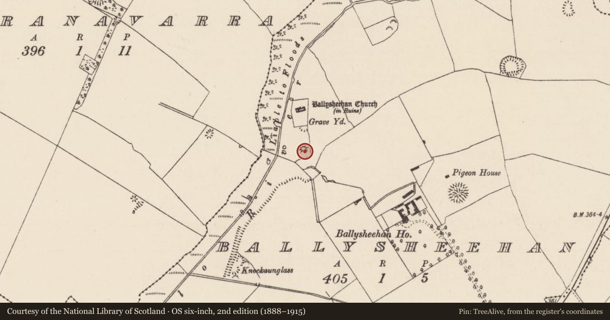
The record
- Townland
- Ballysheehan (Ballysheehan Par.)
- County
- Tipperary South
- Country
- Ireland
- First-edition OS map
- Hachured
- Latest-edition OS map
- Hachured
- Coordinates
- 52.55964, -7.86489
- SMR number
- TS053-042002-
Slide toward Today to fade the historical sheet and see the modern map underneath.
David Rumsey Map Collection, Stanford LibrariesDavid Rumsey Map Collection, Stanford LibrariesDavid Rumsey Map Collection, Stanford LibrariesDavid Rumsey Map Collection, Stanford Libraries
4 historical maps cover this location, the earliest the 1790 map "Composite: Ireland." (David Rumsey Map Collection, Stanford Libraries).
Historical maps covering this location
- 1790 · Composite: Ireland. (David Rumsey Map Collection, Stanford Libraries)
- 1882 · Ireland (southern half). (David Rumsey Map Collection, Stanford Libraries)
- 1891 · Ireland 16 (David Rumsey Map Collection, Stanford Libraries)
- 1904 · Sheet 13. (David Rumsey Map Collection, Stanford Libraries)
This record in the National Monuments Service's Historic Environment Viewer ↗
The National Monuments Service's description
In grassland on top of a low gravel ridge running N-S at with good views in all directions, deserted medieval village (TS053-042003-) 200m to NE, fortified church (TS053-042001-) 100m to N and graveyard (TS053-042004-) 80m to N and stream 30m to W. The motte is situated at the S end of this ridge which falls naturally to the W down to the stream and low lying wet marshy land. In 1953 the point of an iron spike, fragment of an iron horse-shoe and five sherds of medieval potery were found in the hummocky field near the motte and bailey (NMI Reg. No. 1953:9-15). Small low flat topped conical mound (H 3-4m; top diam. 13m N-S; 8m E-W; base diam 24m N-S; 20m E-W) with possible bailey area to N at base of mound now defined by a slight rise of ground which is barely visible enclosing a D-shaped area between motte and church and graveyard to N. Small quarry at base of motte on N side with possible wall footings of structure or wall running N-S from base of mound at N. No other features visible.
Compiled by: Jean Farrelly
Date of upload: 26 August 2011
Nearby in the register
- Enclosureunder 1 mi
- Graveyardunder 1 mi
- Churchunder 1 mi
- Settlement deserted - medievalunder 1 mi
Other entries of the same register within about three miles of this one, by straight line.