Sites and Monuments Record · Ireland
Enclosure
Clareen (Ardmayle Par.),Kilbreedy (Ardmayle Par.), County Tipperary South, Ireland
The record
- Townland
- Clareen (Ardmayle Par.),Kilbreedy (Ardmayle Par.)
- County
- Tipperary South
- Country
- Ireland
- First-edition OS map
- Indicated
- Latest-edition OS map
- Hachured
- Coordinates
- 52.55421, -7.94366
- SMR number
- TS052-047----
Slide toward Today to fade the historical sheet and see the modern map underneath.
David Rumsey Map Collection, Stanford LibrariesDavid Rumsey Map Collection, Stanford LibrariesDavid Rumsey Map Collection, Stanford LibrariesDavid Rumsey Map Collection, Stanford Libraries
4 historical maps cover this location, the earliest the 1790 map "Composite: Ireland." (David Rumsey Map Collection, Stanford Libraries).
Historical maps covering this location
- 1790 · Composite: Ireland. (David Rumsey Map Collection, Stanford Libraries)
- 1882 · Ireland (southern half). (David Rumsey Map Collection, Stanford Libraries)
- 1891 · Ireland 16 (David Rumsey Map Collection, Stanford Libraries)
- 1904 · Sheet 13. (David Rumsey Map Collection, Stanford Libraries)
This record in the National Monuments Service's Historic Environment Viewer ↗
The National Monuments Service's description
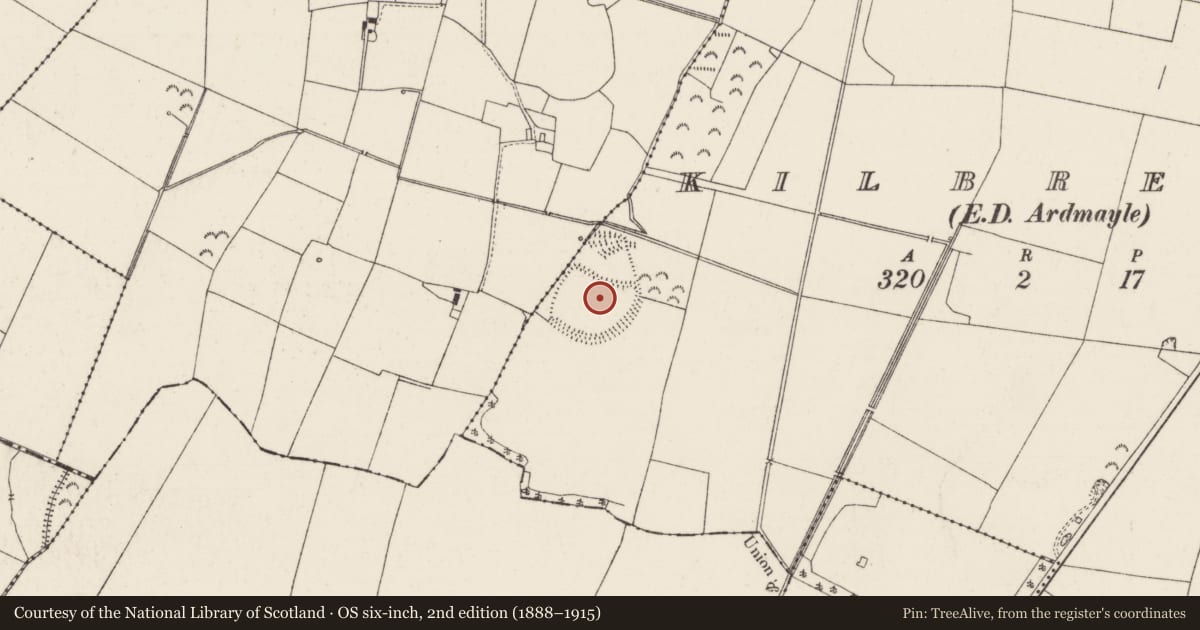
On flat grassland with good views in all directions. Nearby enclosure (TS052-063----) 450m and ringfort (TS052-041----) 840m to NE. Monument consists of a large circular area (int. diam 160m N-S; 110m E-W) enclosed by a well-preserved flat-topped earth and stone bank (top Wth 3.5m; base Wth 5.1m; int. H 0.5m; ext. H 1.2m) and outer fosse (base Wth 4m; top Wth 6m; ext. D 1.1m) and entrance gap (Wth 4.4m) at S. Bank reduced to a scarp along W side of enclosure which runs parallel to a small stream. On latest ed. OS 6-inch map monument is depicted as a D-shaped enclosure with annexe to N of enclosure, however, the bank which divides the annexe from the interior has been levelled. The annexe to the N may be the remains of 19th-century field boundaries which were added onto the N side of the large enclosure. Originally the enclosure may have consisted of a D-shaped enclosure (int. diam. 85m N-S; 110m E-W) with straight side at N (L 80m), which had a later triangular-shaped field boundary added onto the N side of the enclosure which was enclosed by a low well-preserved earth and stone bank (top Wth 2m; base Wth 3.7m; int. H 0.5m; ext. H 0.5m). These later field boudaries may be associated with a house which was added onto the N side of the enclosure. Impressive large circular enclosure which is very well preserved.
Compiled by: Jean Farrelly
Date of upload: 26 August 2011
Nearby in the register
- Enclosureunder 1 mi
- Enclosureunder 1 mi
- Ringfort - rathunder 1 mi
- Earthworkunder 1 mi
Other entries of the same register within about three miles of this one, by straight line.