Sites and Monuments Record · Ireland
Graveslab
Kilcoolyabbey, County Tipperary South, Ireland
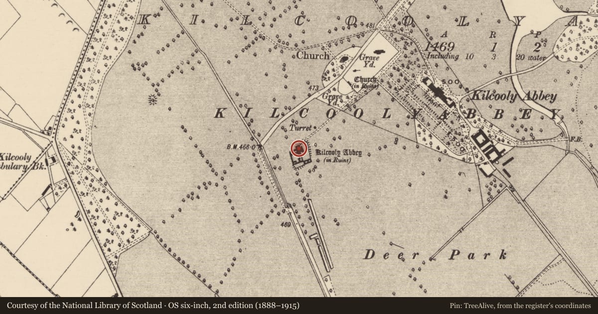
The record
- Townland
- Kilcoolyabbey
- County
- Tipperary South
- Country
- Ireland
- First-edition OS map
- Not indicated
- Latest-edition OS map
- Not indicated
- Coordinates
- 52.67085, -7.57119
- SMR number
- TS043-034019-
Slide toward Today to fade the historical sheet and see the modern map underneath.
David Rumsey Map Collection, Stanford LibrariesDavid Rumsey Map Collection, Stanford LibrariesDavid Rumsey Map Collection, Stanford LibrariesDavid Rumsey Map Collection, Stanford Libraries
4 historical maps cover this location, the earliest the 1790 map "Composite: Ireland." (David Rumsey Map Collection, Stanford Libraries).
Historical maps covering this location
- 1790 · Composite: Ireland. (David Rumsey Map Collection, Stanford Libraries)
- 1869 · Ireland. (David Rumsey Map Collection, Stanford Libraries)
- 1891 · Ireland 16 (David Rumsey Map Collection, Stanford Libraries)
- 1904 · Sheet 13. (David Rumsey Map Collection, Stanford Libraries)
This record in the National Monuments Service's Historic Environment Viewer ↗
The National Monuments Service's description
Secured to the N wall of the chancel of Kilcooly Abbey (TS043-034001-), within the western recess. A limestone rectangular slab (H 2.1m; Wth 0.71m; T 0.17m) with no chamfered edge. It is decorated with a banded seven-armed floriated cross, with a three bar knop at the base of the cross head, the shaft resting on a curving Calvary mount. The banding consists of two rectangular interlocked bands which fall vertically from a horizontal position beneath the knop. There is a latin inscription in raised black letter script, within a margin, which starts on the lower dexter side, continues along the top and terminates three-quarters of the way along the sinister side, the margin continues around the base of the slab. The inscription has been transcribed by Carrigan (1903, 455) as: HIC IACET JOHANES CATWELL QUODA DUS DE MOYLASSAIN Qi OBIIT I VIGILA SCI / PATRICI A DO M/ CCCCCXXXII ET ELICIA STOUC EI' UXOR / RORICUS OTWNYE SCRIPSIT and translated as: Here lie John Cantwell formerly lord of Moylassain, who died March 16th 1532, and Ellis Stoke his wife. Rory O'Tunny wrote this.
Compiled by: Jean Farrelly
Date of upload: 26 August 2011
This monument is subject to a preservation order made under the National Monuments Acts 1930 to 2014 (PO no. 3/2010).
References
Carrigan, Rev. W. 1903 Kilcooley Abbey. Journal of the Association for the Preservation of the Memorials of the Dead vol. 5, 452-7.
Nearby in the register
- Graveslabunder 1 mi
- Tomb - effigialunder 1 mi
- Graveslabunder 1 mi
- Fontunder 1 mi
Other entries of the same register within about three miles of this one, by straight line.