Sites and Monuments Record · Ireland
Dovecote
Kilcoolyabbey, County Tipperary South, Ireland
The record
- Townland
- Kilcoolyabbey
- County
- Tipperary South
- Country
- Ireland
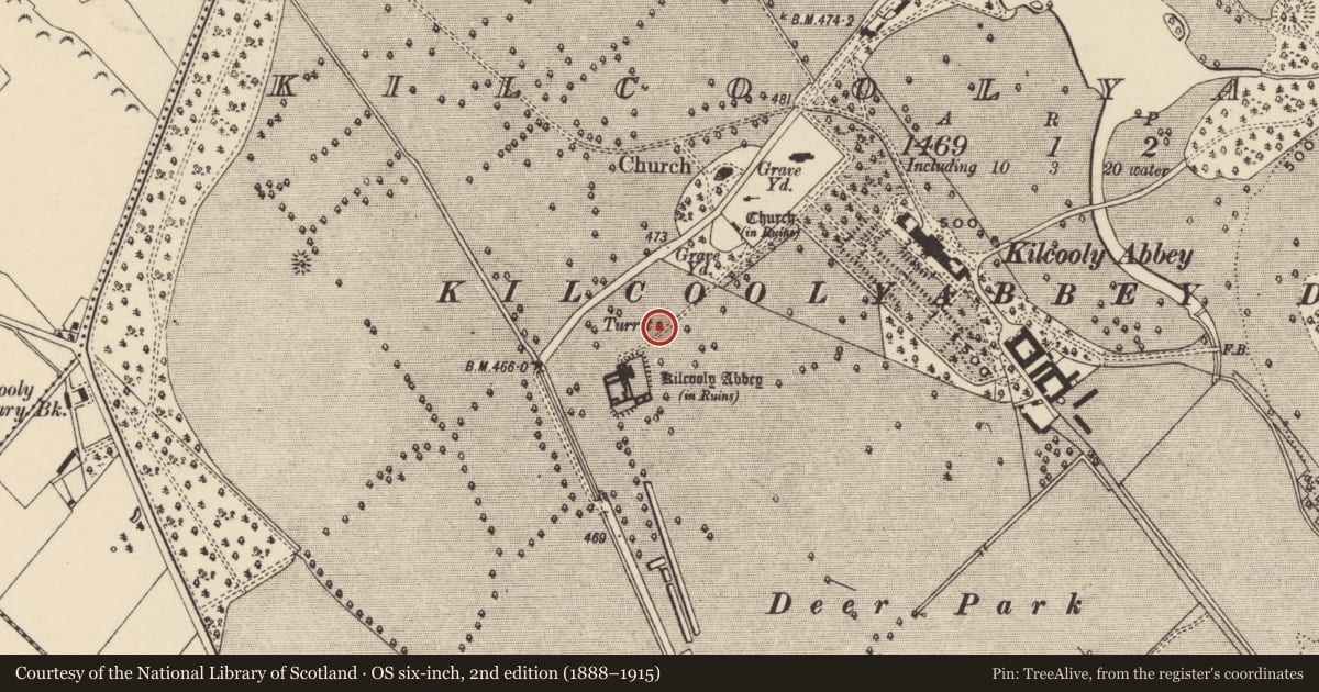
- First-edition OS map
- Turret
- Latest-edition OS map
- Turret
- Coordinates
- 52.67136, -7.57051
- SMR number
- TS043-034004-
Slide toward Today to fade the historical sheet and see the modern map underneath.
David Rumsey Map Collection, Stanford LibrariesDavid Rumsey Map Collection, Stanford LibrariesDavid Rumsey Map Collection, Stanford LibrariesDavid Rumsey Map Collection, Stanford Libraries
4 historical maps cover this location, the earliest the 1790 map "Composite: Ireland." (David Rumsey Map Collection, Stanford Libraries).
Historical maps covering this location
- 1790 · Composite: Ireland. (David Rumsey Map Collection, Stanford Libraries)
- 1869 · Ireland. (David Rumsey Map Collection, Stanford Libraries)
- 1891 · Ireland 16 (David Rumsey Map Collection, Stanford Libraries)
- 1904 · Sheet 13. (David Rumsey Map Collection, Stanford Libraries)
This record in the National Monuments Service's Historic Environment Viewer ↗
The National Monuments Service's description
In gently undulating, though relatively flat, terrain. Kilcooley Abbey (TS043-034001-) is located 70m to the SW. The SE portion of the dovecote is built into a low slope, at which point the external ground level is c. 0.65m higher than the internal. This circular structure (diam. 4.2m) is constructed of limestone rubble, roughly coursed (wall T 0.75m; ext. H to base of roof 3m) with a steep stone corbelled roof (H c. 3m) which has a central circular opening. The doorway (H 2m; Wth 0.47m) in the NW facing wall is a crude rebuild. There appear to have been 12 courses of nesting boxes, made up of horizontal and vertical slabs, most of which have not survived.
See attached photographs:
TS043-034004-_01 External view
TS043-034004-_02 External view with Kilcooley abbey (TS043-034001-) in the background
TS043-034004-_03 Internal view of walling with remains of nest boxes and corbelled roof
TS043-034004-_04 Opening at apex of corbelled roof
Compiled by: Jean Farrelly
Date of upload: 26 August 2011
This monument is subject to a preservation order made under the National Monuments Acts 1930 to 2014 (PO no. 3/2010).
Nearby in the register
- Tomb - effigialunder 1 mi
- Graveslabunder 1 mi
- Graveslabunder 1 mi
- Tomb - effigialunder 1 mi
Other entries of the same register within about three miles of this one, by straight line.