Sites and Monuments Record · Ireland
Church
Ballymurreen, County Tipperary North, Ireland
The record
- Townland
- Ballymurreen
- County
- Tipperary North
- Country
- Ireland
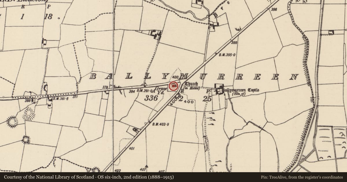
- Latest-edition OS map
- Church (in Ruins)
- Coordinates
- 52.63275, -7.75071
- SMR number
- TN048-015----
Slide toward Today to fade the historical sheet and see the modern map underneath.
David Rumsey Map Collection, Stanford LibrariesDavid Rumsey Map Collection, Stanford LibrariesDavid Rumsey Map Collection, Stanford LibrariesDavid Rumsey Map Collection, Stanford Libraries
4 historical maps cover this location, the earliest the 1790 map "Composite: Ireland." (David Rumsey Map Collection, Stanford Libraries).
Historical maps covering this location
- 1790 · Composite: Ireland. (David Rumsey Map Collection, Stanford Libraries)
- 1869 · Ireland. (David Rumsey Map Collection, Stanford Libraries)
- 1891 · Ireland 16 (David Rumsey Map Collection, Stanford Libraries)
- 1904 · Sheet 13. (David Rumsey Map Collection, Stanford Libraries)
This record in the National Monuments Service's Historic Environment Viewer ↗
The National Monuments Service's description
Situated on a low rise of ground with good views in all directions and a nearby castle site (TN048-016) to the E. Described in the Civil Survey 1654-6 as a 'church enclosed by a ditch' (Simington 1931, vol. 1, 371). A poorly preserved nave (ext. dims. 8.96m N-S; 16.7m E-W; wall T 0.8m) and chancel (7.16m N-S; 7.6m E-W) church constructed with roughly coursed limestone rubble. The nave is best preserved with the W gable intact and central portions of the N and S walls surviving to full height. Only the lower courses of the walls of the chancel survive. A round-arched doorway of seventeenth/eighteenth-century appearance is located at the W end of the S wall of the nave. A single-light window in the centre of the W gable is now obscured by ivy. The graveyard (TN048-015001) wall has been recently restored by a local community scheme enclosing eighteenth and nineteenth-century headstones.
The above description is derived from 'The Archaeological Inventory of County Tipperary. Vol. 1 - North Tipperary' compiled by Jean Farrelly and Caimin O'Brien (Dublin: Stationery Office, 2002). In certain instances the entries have been revised and updated in the light of recent research.
See attached photographs taken on 11 May 2023
TN048-015----_01Church from NE
TN048-015----_02 W gable and S wall of nave - exterior
TN048-015----_03 Interior of nave from NE
TN048-015----_04 Doorway in S wall of nave - W end - interior
Date of upload/revision: 22 September 2008
Nearby in the register
- Graveyardunder 1 mi
- Castle - unclassifiedunder 1 mi
- Bawnunder 1 mi
- Enclosureunder 1 mi
Other entries of the same register within about three miles of this one, by straight line.