Sites and Monuments Record · Ireland
Mill - unclassified
Monamoe, County Tipperary North, Ireland
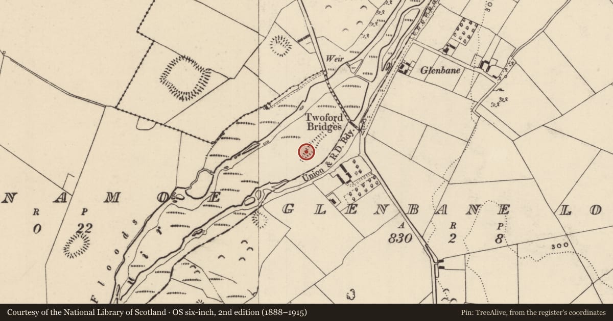
The record
- Townland
- Monamoe
- County
- Tipperary North
- Country
- Ireland
- First-edition OS map
- NULL
- Latest-edition OS map
- Hachured
- Coordinates
- 52.61430, -7.89724
- SMR number
- TN047-117003-
Slide toward Today to fade the historical sheet and see the modern map underneath.
David Rumsey Map Collection, Stanford LibrariesDavid Rumsey Map Collection, Stanford LibrariesDavid Rumsey Map Collection, Stanford LibrariesDavid Rumsey Map Collection, Stanford Libraries
4 historical maps cover this location, the earliest the 1790 map "Composite: Ireland." (David Rumsey Map Collection, Stanford Libraries).
Historical maps covering this location
- 1790 · Composite: Ireland. (David Rumsey Map Collection, Stanford Libraries)
- 1869 · Ireland. (David Rumsey Map Collection, Stanford Libraries)
- 1891 · Ireland 16 (David Rumsey Map Collection, Stanford Libraries)
- 1904 · Sheet 13. (David Rumsey Map Collection, Stanford Libraries)
This record in the National Monuments Service's Historic Environment Viewer ↗
The National Monuments Service's description
Situated on the NE end of Monamoe Island in the River Suir, c. 3.5km SW of Holycross Abbey. The millrace runs NE-SW and consists of a concave channel (Wth 3m) with an earth and stone bank (max. Wth 1.4m; int. H 0.5m; ext. H 0.3m) on either side. The race widens out to form a flat-bottomed, oval-shaped millpond (TN047-117002), which is wet and muddy. A substantial bank encloses the pond. The millrace runs c. 100m either side of the pond. There is no visible trace of the mill (TN047-117001) itself.
Compiled by: Caimin O'Brien.
Date of upload: 22 September 2008
Nearby in the register
- Mill - unclassifiedunder 1 mi
- Mill - unclassifiedunder 1 mi
- Enclosureunder 1 mi
- Enclosureunder 1 mi
Other entries of the same register within about three miles of this one, by straight line.