Sites and Monuments Record · Ireland
Architectural fragment
Beakstown, County Tipperary North, Ireland
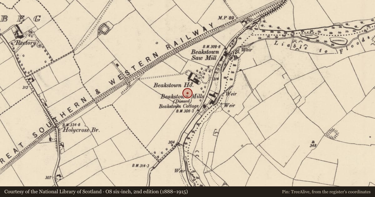
The record
- Townland
- Beakstown
- County
- Tipperary North
- Country
- Ireland
- First-edition OS map
- NULL
- Latest-edition OS map
- Not indicated
- Coordinates
- 52.64989, -7.86553
- SMR number
- TN047-008003-
Slide toward Today to fade the historical sheet and see the modern map underneath.
David Rumsey Map Collection, Stanford LibrariesDavid Rumsey Map Collection, Stanford LibrariesDavid Rumsey Map Collection, Stanford LibrariesDavid Rumsey Map Collection, Stanford Libraries
4 historical maps cover this location, the earliest the 1790 map "Composite: Ireland." (David Rumsey Map Collection, Stanford Libraries).
Historical maps covering this location
- 1790 · Composite: Ireland. (David Rumsey Map Collection, Stanford Libraries)
- 1869 · Ireland. (David Rumsey Map Collection, Stanford Libraries)
- 1891 · Ireland 16 (David Rumsey Map Collection, Stanford Libraries)
- 1904 · Sheet 13. (David Rumsey Map Collection, Stanford Libraries)
This record in the National Monuments Service's Historic Environment Viewer ↗
The National Monuments Service's description
In 2000 archaeological rescue survey of the spoil heap of the levelled Beakstown House by Paul Stevens recovered 134 dressed stone fragments, including 120 late medieval quoins, a late medieval ogee arch fragment, two corbels, two Tudor chamfered door-jambs and a date stone of 1699 now incorporated into the boundary wall of the property. This rescue work was carried out under licence No. 00E0205 (Bennett 2002, 321).
Compiled by: Caimin O'Brien.
Date of upload: 22 September 2008
Nearby in the register
- Castle - unclassifiedunder 1 mi
- Enclosureunder 1 mi
- Water mill - unclassifiedunder 1 mi
- Enclosureunder 1 mi
Other entries of the same register within about three miles of this one, by straight line.