Sites and Monuments Record · Ireland
Moated site
Noard, County Tipperary North, Ireland
The record
- Townland
- Noard
- County
- Tipperary North
- Country
- Ireland
- First-edition OS map
- NULL
- Latest-edition OS map
- Hachured
- Coordinates
- 52.66702, -7.68427
- SMR number
- TN042-054----
Slide toward Today to fade the historical sheet and see the modern map underneath.
David Rumsey Map Collection, Stanford LibrariesDavid Rumsey Map Collection, Stanford LibrariesDavid Rumsey Map Collection, Stanford LibrariesDavid Rumsey Map Collection, Stanford Libraries
4 historical maps cover this location, the earliest the 1790 map "Composite: Ireland." (David Rumsey Map Collection, Stanford Libraries).
Historical maps covering this location
- 1790 · Composite: Ireland. (David Rumsey Map Collection, Stanford Libraries)
- 1869 · Ireland. (David Rumsey Map Collection, Stanford Libraries)
- 1891 · Ireland 16 (David Rumsey Map Collection, Stanford Libraries)
- 1904 · Sheet 13. (David Rumsey Map Collection, Stanford Libraries)
This record in the National Monuments Service's Historic Environment Viewer ↗
The National Monuments Service's description
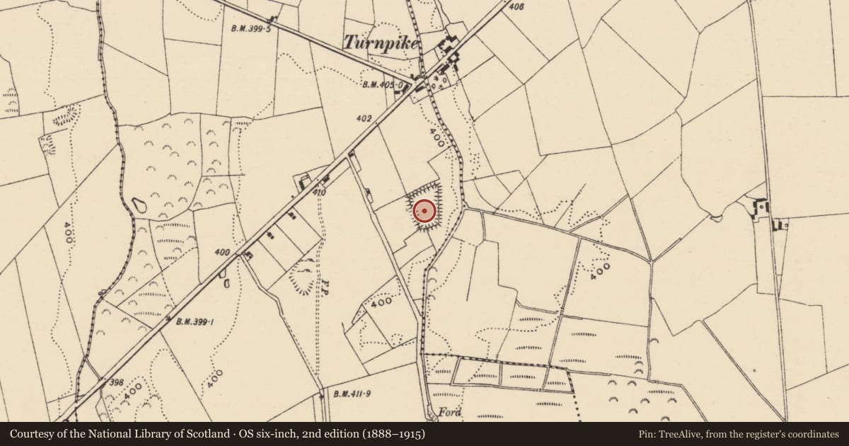
Situated on a low N-S ridge in flat pasture with the Derheen River 40m to the E. Depicted as a trapezoidal-shaped enclosure on the 1903 ed. OS 6-inch map. During a recent archaeological assessment carried out in November of 2010 under excavation licence number 10E448, the cropmark of the levelled monument was visible on the S, W and N sides (Henry 2010, 3). The levelled monument was described as consisting of a slightly raised sub-rectangular area (dims. 70m N-S x 30m E-W) defined by a crop-mark of a levelled bank (Wth 3.7m) that is enclosed by an in-filled fosse (Wth 4m) which is visible as a slight dip in the ground (Henry 2010, 3-4). This monument is depicted as a trapezoidal shaped field with a laneway running onto the wider N side of the field (Wth c. 60m E-W) which connected the site to the public road to the W. The field is narrower at the S end where it measures c. 30m wide. A building is depicted outside the SE angle of the enclosure on the first edition of the OS 6-inch map. This monument is not depicted as an antiquity on the first edition of the OS 6-inch map and is shown as a hachured trapezoidal-shaped enclosure on the revised editions of the OS 6-inch maps.
The above description is derived from 'The Archaeological Inventory of County Tipperary. Vol. 1 - North Tipperary' compiled by Jean Farrelly and Caimin O'Brien (Dublin: Stationery Office, 2002). In certain instances the entries have been revised and updated in the light of recent research.
Henry, M. 2010 'Archaeological Impact Assessment of a Proposed House Site at Noard, Twomileborris, Thurles, Co. Tipperary', Unpublished Report, National Monuments Service Archive.
Date of upload/revision: 24 November 2010
Nearby in the register
- Ecclesiastical siteunder 1 mi
- Churchunder 1 mi
- Round towerunder 1 mi
- Settlement deserted - medievalunder 1 mi
Other entries of the same register within about three miles of this one, by straight line.