Sites and Monuments Record · Ireland
Castle - unclassified
Graiguefrahane, County Tipperary North, Ireland
The record
- Townland
- Graiguefrahane
- County
- Tipperary North
- Country
- Ireland
- First-edition OS map
- Partially indicated
- Latest-edition OS map
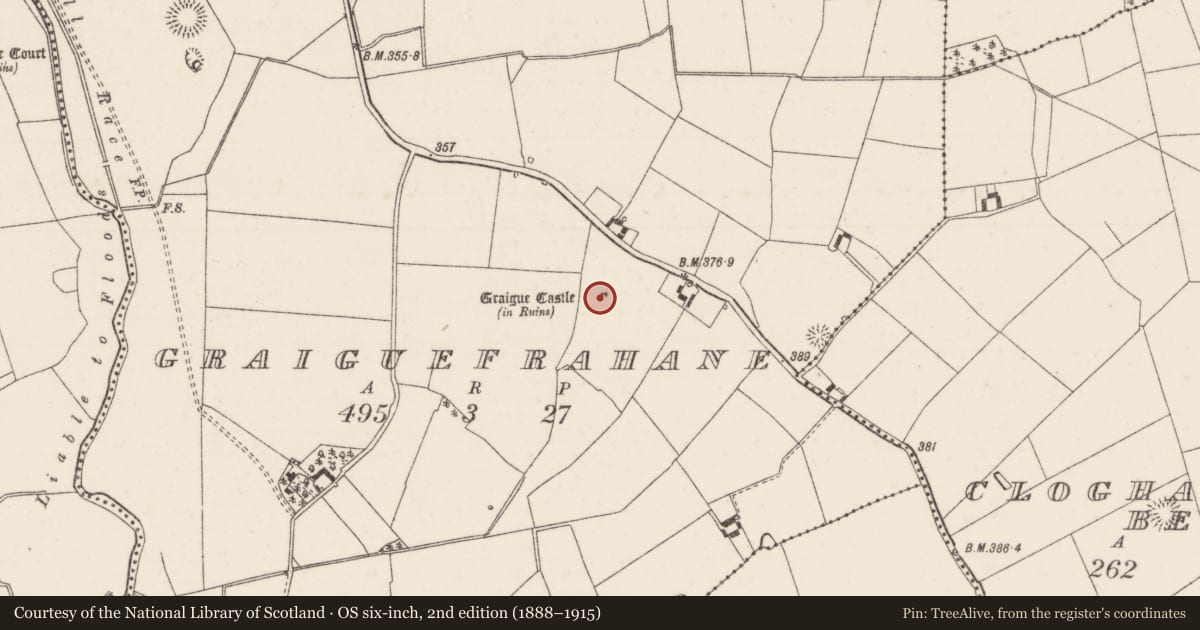
- Graigue Castle (in Ruins)
- Coordinates
- 52.75190, -7.81206
- SMR number
- TN035-037----
Slide toward Today to fade the historical sheet and see the modern map underneath.
David Rumsey Map Collection, Stanford LibrariesDavid Rumsey Map Collection, Stanford LibrariesDavid Rumsey Map Collection, Stanford LibrariesDavid Rumsey Map Collection, Stanford Libraries
4 historical maps cover this location, the earliest the 1790 map "Composite: Ireland." (David Rumsey Map Collection, Stanford Libraries).
Historical maps covering this location
- 1790 · Composite: Ireland. (David Rumsey Map Collection, Stanford Libraries)
- 1868 · 4. Ireland. (David Rumsey Map Collection, Stanford Libraries)
- 1869 · Ireland. (David Rumsey Map Collection, Stanford Libraries)
- 1891 · Ireland 16 (David Rumsey Map Collection, Stanford Libraries)
This record in the National Monuments Service's Historic Environment Viewer ↗
The National Monuments Service's description
Situated on high ground in undulating countryside with a fortified house (TN035-030----) to the NW. Cited as a Purcell castle in the OS Letters where it is described as the 'old Castle of Cloghleigh' (O'Flanagan 1930, vol. 1, 181). Depicted as a rectangular structure with its long axis aligned N-S on the 1838 ed. OS 6-inch map. On the revised OS 6-inch map only the N wall and N section of the W wall and N return of the NE angle of the castle walls were depicted. No visible remains at ground level.
The above description is derived from 'The Archaeological Inventory of County Tipperary. Vol. 1 - North Tipperary' compiled by Jean Farrelly and Caimin O'Brien (Dublin: Stationery Office, 2002). In certain instances the entries have been revised and updated in the light of recent research.
Compiled by: Caimin O'Brien
Date of revised upload: 19 September 2016
References
O'Flanagan, Rev. M. (Compiler) 1930 Letters containing information relative to the antiquities of the county of Tipperary collected during the progress of the Ordnance Survey in 1840. Bray.
Nearby in the register
- Ringfort - rathunder 1 mi
- Enclosureunder 1 mi
- Ringfort - rathunder 1 mi
- Ringfort - rathunder 1 mi
Other entries of the same register within about three miles of this one, by straight line.