Sites and Monuments Record · Ireland
Graveyard
Glenkeen, County Tipperary North, Ireland
The record
- Townland
- Glenkeen
- County
- Tipperary North
- Country
- Ireland
- First-edition OS map
- NULL
- Latest-edition OS map
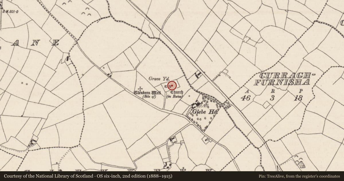
- Church (in Ruins), Grave Yd.
- Coordinates
- 52.76638, -7.98204
- SMR number
- TN034-013003-
Slide toward Today to fade the historical sheet and see the modern map underneath.
David Rumsey Map Collection, Stanford LibrariesDavid Rumsey Map Collection, Stanford LibrariesDavid Rumsey Map Collection, Stanford LibrariesDavid Rumsey Map Collection, Stanford Libraries
4 historical maps cover this location, the earliest the 1790 map "Composite: Ireland." (David Rumsey Map Collection, Stanford Libraries).
Historical maps covering this location
- 1790 · Composite: Ireland. (David Rumsey Map Collection, Stanford Libraries)
- 1811 · Ireland. (David Rumsey Map Collection, Stanford Libraries)
- 1869 · Ireland. (David Rumsey Map Collection, Stanford Libraries)
- 1891 · Ireland 16 (David Rumsey Map Collection, Stanford Libraries)
This record in the National Monuments Service's Historic Environment Viewer ↗
The National Monuments Service's description
Situated on an E-facing slope of rising ground in an upland area with a nearby holy well site (TN034-012) to the W. Founded by St Culan in the seventh century (Gwynn and Hadcock 1970, 385). The bell shrine of St Culan, a twelfth-century reliquary, was found in a nearby hollow tree (Cooke 1822, 33-9) close to the site of the holy well. The poorly preserved remains of a nave and chancel church, the chancel of which is totally destroyed, with partial remains of the N and S walls and the W gable fully intact. An armorial plaque and graveslab (TN034-013004) dedicated to Walter Burke of Illeigh erected in 1626 by Patrick Kerin (White 1892, 33) is inserted into the E end of the N wall of the nave. An old mill (TN034-013002) was discovered in 1821 near the church. Church (TN034-013001) located on top of high ground in centre of large graveyard enclosed by a 19th century wall. Memorials of 18th and 19th century date contained within graveyard.
Compiled by: Caimin O'Brien.
Date of upload: 22 September 2008
Nearby in the register
- Graveslabunder 1 mi
- Memorial stoneunder 1 mi
- Churchunder 1 mi
- Water mill - horizontal-wheeledunder 1 mi
Other entries of the same register within about three miles of this one, by straight line.