Sites and Monuments Record · Ireland
Graveslab
Ballynaclogh, County Tipperary North, Ireland
The record
- Townland
- Ballynaclogh
- County
- Tipperary North
- Country
- Ireland
- First-edition OS map
- Not indicated
- Latest-edition OS map
- Not indicated
- Coordinates
- 52.82563, -8.16003
- SMR number
- TN027-003007-
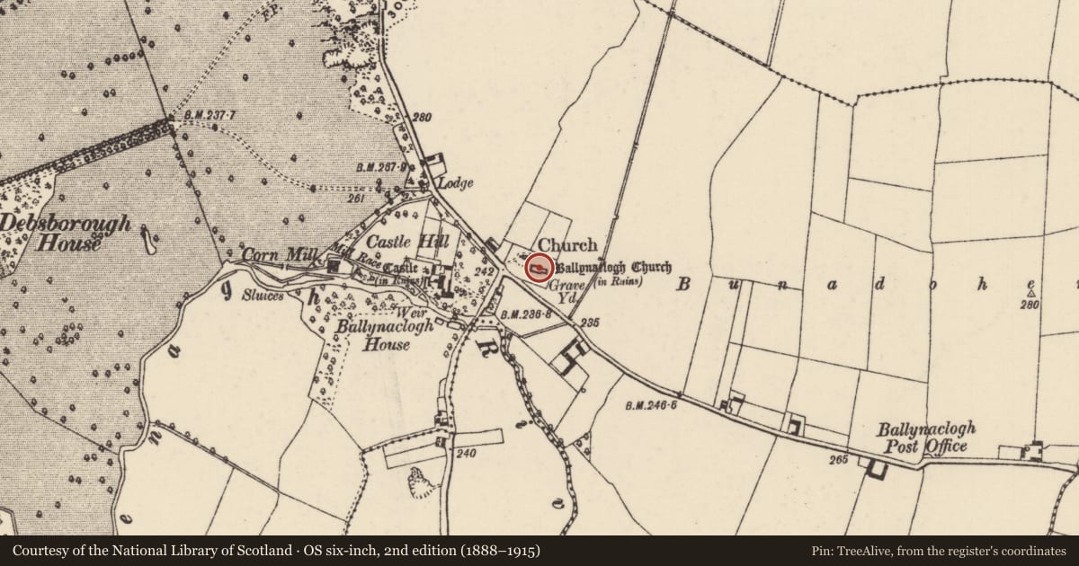
Slide toward Today to fade the historical sheet and see the modern map underneath.
David Rumsey Map Collection, Stanford LibrariesDavid Rumsey Map Collection, Stanford LibrariesDavid Rumsey Map Collection, Stanford LibrariesDavid Rumsey Map Collection, Stanford Libraries
4 historical maps cover this location, the earliest the 1790 map "Composite: Ireland." (David Rumsey Map Collection, Stanford Libraries).
Historical maps covering this location
- 1790 · Composite: Ireland. (David Rumsey Map Collection, Stanford Libraries)
- 1811 · Ireland. (David Rumsey Map Collection, Stanford Libraries)
- 1869 · Ireland. (David Rumsey Map Collection, Stanford Libraries)
- 1891 · Ireland 16 (David Rumsey Map Collection, Stanford Libraries)
This record in the National Monuments Service's Historic Environment Viewer ↗
The National Monuments Service's description
Situated in the E half of a rectangular graveyard (TN027-003006-), immediately SE of a Protestant church. Listed in the ecclesiastical taxation of the Diocese of Killaloe in 1302 where it is referred to as 'Church de Vado petroso' (CDI, vol. 5, 301). A nave and chancel church (TN027-003002-) built of roughly coursed limestone rubble which has been heavily repointed. Some dressed limestone quoins survive and of particular note is a sheela-na-gig (TN027-003003-) carved in relief on the S face of a quoin in the SW angle. Only the top half of a medieval floriated tapering graveslab (dims. H 0.54m; Top Wth 0.5m; base Wth 0.45m; avg. T 0.2m) standing upright in the chancel of the church is visible above the surface of the church. The weathered slab is decorated with a poorly preserved fleur-de-lis carved in false relief with a raised border or band (Wth 0.03m) running around the edge of the slab. On one side of the upright slab there are the remains of a shallow roll moulding running up the side the slab, this feature may have acted as a stop for the slab when it was resting on top of the stone coffin.
To see a 3D model of the graveslab visit: https://skfb.ly/owZpC
Compiled and revised by: Caimin O'Brien.
Date of revised upload: 16 August 2022
References
Cal. doc. Ire. - Calendar of documents relating to Ireland 1171-1307, ed. H.S. Sweetman (5 vols., London, 1875-86).
Nearby in the register
Other entries of the same register within about three miles of this one, by straight line.