Sites and Monuments Record · Ireland
Church
Skehanagh (Killavinoge Par.), County Tipperary North, Ireland
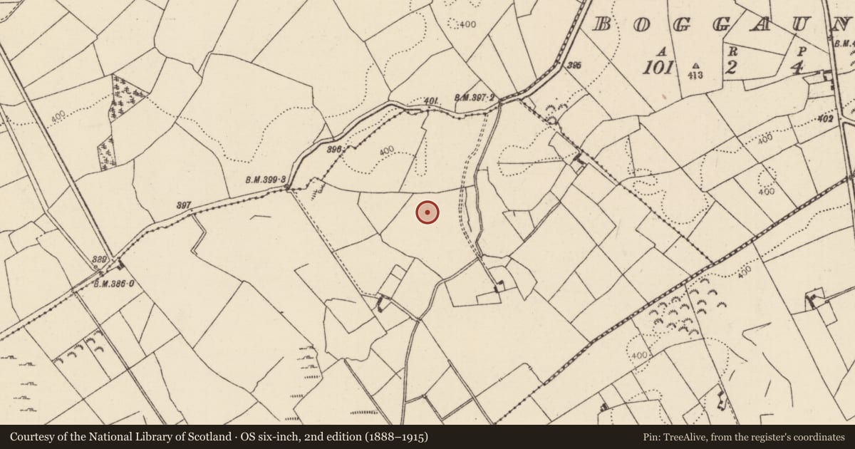
The record
- Townland
- Skehanagh (Killavinoge Par.)
- County
- Tipperary North
- Country
- Ireland
- Latest-edition OS map
- Not indicated
- Coordinates
- 52.85244, -7.78150
- SMR number
- TN023-046001-
Slide toward Today to fade the historical sheet and see the modern map underneath.
David Rumsey Map Collection, Stanford LibrariesDavid Rumsey Map Collection, Stanford LibrariesDavid Rumsey Map Collection, Stanford LibrariesDavid Rumsey Map Collection, Stanford Libraries
4 historical maps cover this location, the earliest the 1790 map "Composite: Ireland." (David Rumsey Map Collection, Stanford Libraries).
Historical maps covering this location
- 1790 · Composite: Ireland. (David Rumsey Map Collection, Stanford Libraries)
- 1811 · Ireland. (David Rumsey Map Collection, Stanford Libraries)
- 1869 · Ireland. (David Rumsey Map Collection, Stanford Libraries)
- 1891 · Ireland 16 (David Rumsey Map Collection, Stanford Libraries)
This record in the National Monuments Service's Historic Environment Viewer ↗
The National Monuments Service's description
Situated on the N-facing slope of a slight rise in undulating reclaimed pastureland. A stream and a children's burial ground (TN023-047) are located c. 60m to the E. Not marked on either the 1st (1840) or the 1904 ed. OS 6-inch map but recorded in the Schools Manuscript (Stout 1984, 105-6). Stout also mentions that a gable wall (H 4.5m) 'survived into this generation' (it is unclear which generation this refers to). According to the landowner the ground was bulldozed some 30-35 years ago (c. 1960s) and burial(s), orientated E-W were found. He had also stated that in dry weather a square area, c. 5.5m wide, is burnt in the grass in the area where the wall stood and that bones 'turned up under flags' during ploughing (Stout 1984, 105-6).
The above description is derived from 'The Archaeological Inventory of County Tipperary. Vol. 1 - North Tipperary' compiled by Jean Farrelly and Caimin O'Brien (Dublin: Stationery Office, 2002). In certain instances the entries have been revised and updated in the light of recent research.
Date of upload/revision: 22 September 2008
Nearby in the register
- Graveyardunder 1 mi
- Children's burial groundunder 1 mi
- Churchunder 1 mi
- Castle - unclassifiedunder 1 mi
Other entries of the same register within about three miles of this one, by straight line.