Sites and Monuments Record · Ireland
Tomb - effigial
Castlequarter (Aghameadle Par.),Bunacum, County Tipperary North, Ireland
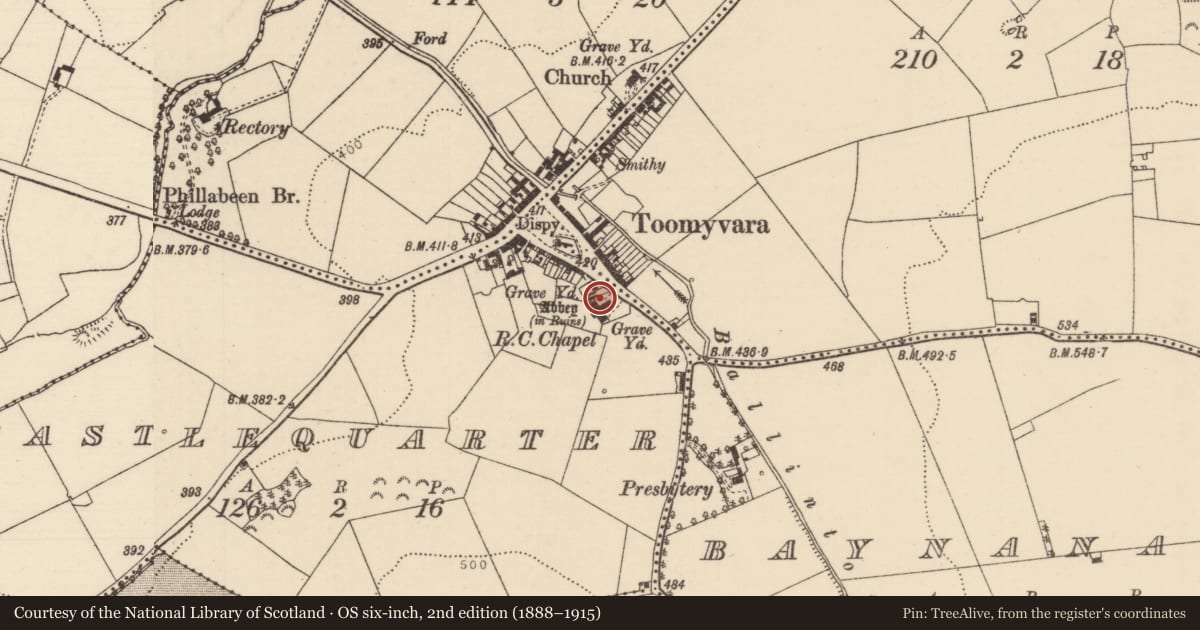
The record
- Townland
- Castlequarter (Aghameadle Par.),Bunacum
- County
- Tipperary North
- Country
- Ireland
- Latest-edition OS map
- Not indicated
- Coordinates
- 52.84906, -8.03455
- SMR number
- TN022-070006-
Slide toward Today to fade the historical sheet and see the modern map underneath.
David Rumsey Map Collection, Stanford LibrariesDavid Rumsey Map Collection, Stanford LibrariesDavid Rumsey Map Collection, Stanford LibrariesDavid Rumsey Map Collection, Stanford Libraries
4 historical maps cover this location, the earliest the 1790 map "Composite: Ireland." (David Rumsey Map Collection, Stanford Libraries).
Historical maps covering this location
- 1790 · Composite: Ireland. (David Rumsey Map Collection, Stanford Libraries)
- 1811 · Ireland. (David Rumsey Map Collection, Stanford Libraries)
- 1869 · Ireland. (David Rumsey Map Collection, Stanford Libraries)
- 1891 · Ireland 16 (David Rumsey Map Collection, Stanford Libraries)
This record in the National Monuments Service's Historic Environment Viewer ↗
The National Monuments Service's description
Situated on a slight rise of ground in undulating countryside in the centre of Toomevara village with a possible church ruins (TN022-070001-) to the N. The poorly preserved remains of an Augustinian priory (TN022-070002-) dedicated to St Mary which was founded some time after 1140 (Gwynn and Hadcock 1970, 155) possibly on the site of an earlier monastic centre dedicated to St Donain. A late fifteenth-century effigial tomb (dims. L 1.33m; top Wth 0.54m; base Wth 0.54m; T 0.17m) described by Hunt (1974, vol. 1, 94, 96, 231) lies outside the S wall at the E end of the Augustinian priory. Described by Gleeson as 'Outside the N wall is a 15th cent. Stone slab showing an ecclesiastic and inscribed in raised letters now partly erased. The name 'Joannes O'Meara' can be read' (Gleeson 1951-2, 133).
Compiled by: Caimin O'Brien.
Date of upload: 22 September 2008
References
Gwynn, A. and Hadcock, R.N. 1970 (Reprint 1988) Medieval religious houses of Ireland. Dublin. Irish Academic Press.
Gleeson, D.F. 1951-2 Churches in the deanery of Ormond. North Munster Antiquarian Journal 6, 96-107, 130-35.
Hunt, J. 1974 Irish medieval figure sculpture 1200-1600, 2 vols. Dublin. Irish University Press.
Nearby in the register
- Memorial stoneunder 1 mi
- Religious house - Augustinian friarsunder 1 mi
- Fontunder 1 mi
- Graveyardunder 1 mi
Other entries of the same register within about three miles of this one, by straight line.