Sites and Monuments Record · Ireland
Graveslab
Lorrha, County Tipperary North, Ireland
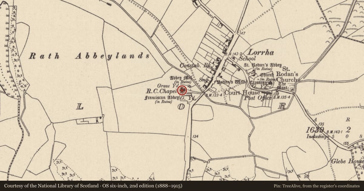
The record
- Townland
- Lorrha
- County
- Tipperary North
- Country
- Ireland
- Latest-edition OS map
- Not indicated
- Coordinates
- 53.09126, -8.12628
- SMR number
- TN004-010002-
Slide toward Today to fade the historical sheet and see the modern map underneath.
David Rumsey Map Collection, Stanford LibrariesDavid Rumsey Map Collection, Stanford LibrariesDavid Rumsey Map Collection, Stanford LibrariesDavid Rumsey Map Collection, Stanford Libraries
4 historical maps cover this location, the earliest the 1790 map "Composite: Ireland." (David Rumsey Map Collection, Stanford Libraries).
Historical maps covering this location
- 1790 · Composite: Ireland. (David Rumsey Map Collection, Stanford Libraries)
- 1811 · Ireland. (David Rumsey Map Collection, Stanford Libraries)
- 1869 · Ireland. (David Rumsey Map Collection, Stanford Libraries)
- 1891 · Ireland 16 (David Rumsey Map Collection, Stanford Libraries)
This record in the National Monuments Service's Historic Environment Viewer ↗
The National Monuments Service's description
Situated inside Lorrha Roman Catholic church adjacent to the Dominican Friary (TN004-010001-). The limestone graveslab (L 2m x Wth c. 0.9m) is decorated with a six-armed circular cross head with fleur-de-lys terminals, in the centre of which is an I H S motif. There is a sun and moon motif above the cross and both sides of the shaft are in Latin, carved in relief in Gothic script. The shaft rests on a stepped calvary mount. The marginal inscription in Latin commemorates Patrick O'Hogan of Shearragh and his wife Johanna Dalachan who had this tomb made in 1626.
Compiled by: Jean Farrelly and Caimin O'Brien
Date of upload/revision: 22 September 2008
Nearby in the register
- Bullaun stoneunder 1 mi
- Stone headunder 1 mi
- Stone sculptureunder 1 mi
- Stone headunder 1 mi
Other entries of the same register within about three miles of this one, by straight line.