Sites and Monuments Record · Ireland
Ritual site - holy well
Greenan, County Sligo, Ireland
The record
- Townland
- Greenan
- County
- Sligo
- Country
- Ireland
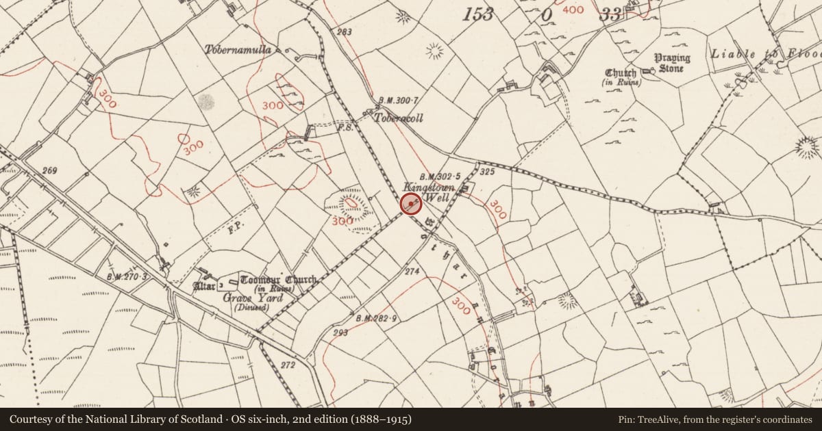
- Latest-edition OS map
- Kingstown Well
- Coordinates
- 54.04112, -8.42605
- SMR number
- SL040-138----
Slide toward Today to fade the historical sheet and see the modern map underneath.
David Rumsey Map Collection, Stanford LibrariesDavid Rumsey Map Collection, Stanford LibrariesDavid Rumsey Map Collection, Stanford LibrariesDavid Rumsey Map Collection, Stanford Libraries
4 historical maps cover this location, the earliest the 1790 map "Composite: Ireland." (David Rumsey Map Collection, Stanford Libraries).
Historical maps covering this location
- 1790 · Composite: Ireland. (David Rumsey Map Collection, Stanford Libraries)
- 1811 · Ireland. (David Rumsey Map Collection, Stanford Libraries)
- 1869 · Ireland. (David Rumsey Map Collection, Stanford Libraries)
- 1891 · Ireland 16 (David Rumsey Map Collection, Stanford Libraries)
This record in the National Monuments Service's Historic Environment Viewer ↗
The National Monuments Service's description
In pasture, at the base of a slope. An unenclosed spring well, covered with overgrowth, and with an ash tree growing out of it. In 1836 it was recorded that there was formerly a 'station' at the well on every Easter Sunday (OSL, 149) while in 1942-4 it was noted that there had been no pilgrimages in the memory of the oldest resident (ITA). There is a local tradition that St Patrick threw a stone from Toomour (SL040-140001-) and the spring rose from where it fell (pers. comm. M. A. Timoney). Also according to local information, c. 30 rounded stones (max. diam. c. 0.3m) from this well were built into the wall outside a public house in Knockoconor townland c. 1.3km to NW (pers. comm. M. A. Timoney). A stretch of the road known as Bothar an Corann (SL033-145----) is c. 40m to the SW. Another holy well called 'Tobernamulla' (SL040-133----) is c. 420m to NW.
The above description is derived from the published 'Archaeological Inventory of County Sligo' compiled by Ursula Egan, Elizabeth Byrne, Mary Sleeman with Sheila Ronan and Connie Murphy (Dublin Stationery Office, 2005).
Date of upload: 18 January 2008
Nearby in the register
- Earthworkunder 1 mi
- Ritual site - holy wellunder 1 mi
- Barrow - embanked barrowunder 1 mi
- Ringfort - rathunder 1 mi
Other entries of the same register within about three miles of this one, by straight line.