Sites and Monuments Record · Ireland
Megalithic tomb - court tomb
Mullaghfarna,Carrowkeel (Tirerrill By., Templevanny ED), County Sligo, Ireland
The record
- Townland
- Mullaghfarna,Carrowkeel (Tirerrill By., Templevanny ED)
- County
- Sligo
- Country
- Ireland
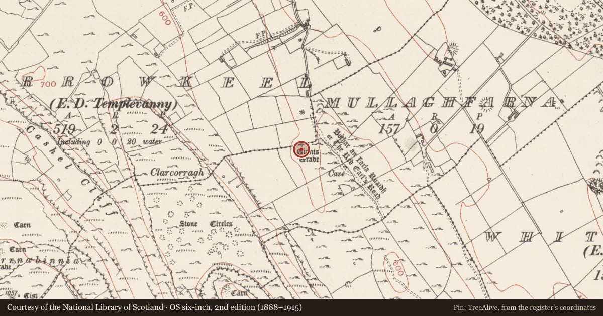
- Latest-edition OS map
- Giants Grave
- Coordinates
- 54.05809, -8.36486
- SMR number
- SL040-098----
Slide toward Today to fade the historical sheet and see the modern map underneath.
David Rumsey Map Collection, Stanford LibrariesDavid Rumsey Map Collection, Stanford LibrariesDavid Rumsey Map Collection, Stanford LibrariesDavid Rumsey Map Collection, Stanford Libraries
4 historical maps cover this location, the earliest the 1790 map "Composite: Ireland." (David Rumsey Map Collection, Stanford Libraries).
Historical maps covering this location
- 1790 · Composite: Ireland. (David Rumsey Map Collection, Stanford Libraries)
- 1869 · Ireland. (David Rumsey Map Collection, Stanford Libraries)
- 1891 · Ireland 16 (David Rumsey Map Collection, Stanford Libraries)
- 1922 · Ireland - northern section. (David Rumsey Map Collection, Stanford Libraries)
This record in the National Monuments Service's Historic Environment Viewer ↗
The National Monuments Service's description
On a little knoll in rocky pasture at the foot of the E flank of the Bricklieve Mountains. This is a gallery (L 6.3m; Wth 2m at front, 0.8m at rear) entered between two jambs at the NW, the more easterly of which is flanked by a single courtstone. There are three stones on the W side of the gallery and four on the E and it is closed by a backstone the top of which has been broken off and now lies on the ground. The gallery contains grass-grown fill which reaches to the level of the sidestones and this extends beyond the front of the monument for about 1.5m. A slab, apparently a roofstone, rests on this fill at the back of the gallery. A stone fence runs E-W across the middle of the gallery. (Ó Nualláin 1989, 75, no. 119)
The above description is derived from the published 'Archaeological Inventory of County Sligo' compiled by Ursula Egan, Elizabeth Byrne, Mary Sleeman with Sheila Ronan and Connie Murphy (Dublin Stationery Office, 2005).
Date of upload: 18 January 2008
See linked document with details and plan from Seán Ó Nualláin, Survey of the Megalithic Tombs of Ireland. Volume V. County Sligo. (Dublin: Stationery Office, 1989)
Nearby in the register
- Hut siteunder 1 mi
- Settlement clusterunder 1 mi
- Ringfort - cashelunder 1 mi
- Megalithic tomb - passage tombunder 1 mi
Other entries of the same register within about three miles of this one, by straight line.