Sites and Monuments Record · Ireland
Structure
Annaghgowla Island, County Sligo, Ireland
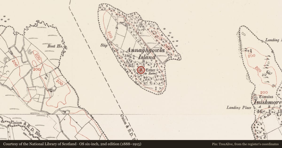
The record
- Townland
- Annaghgowla Island
- County
- Sligo
- Country
- Ireland
- First-edition OS map
- Not indicated
- Latest-edition OS map
- Tower (in Ruins)
- Coordinates
- 54.07301, -8.34020
- SMR number
- SL034-229----
Slide toward Today to fade the historical sheet and see the modern map underneath.
David Rumsey Map Collection, Stanford LibrariesDavid Rumsey Map Collection, Stanford LibrariesDavid Rumsey Map Collection, Stanford LibrariesDavid Rumsey Map Collection, Stanford Libraries
4 historical maps cover this location, the earliest the 1790 map "Composite: Ireland." (David Rumsey Map Collection, Stanford Libraries).
Historical maps covering this location
- 1790 · Composite: Ireland. (David Rumsey Map Collection, Stanford Libraries)
- 1869 · Ireland. (David Rumsey Map Collection, Stanford Libraries)
- 1891 · Ireland 16 (David Rumsey Map Collection, Stanford Libraries)
- 1922 · Ireland - northern section. (David Rumsey Map Collection, Stanford Libraries)
This record in the National Monuments Service's Historic Environment Viewer ↗
The National Monuments Service's description
Listed in the SMR (1989) and RMP (1995) and classified 'Castle'. In mature deciduous forest, on top of a high rounded central point of Annaghgowla Island in Lough Gara. A rectangular one-storey, gable-ended structure built of stone in lime mortar with brick details. The S gable stands almost to full height and the W wall is also well preserved but most of the N and E walls have fallen. There is a central doorway in the S wall, which was framed in brick. There is a brick string course c. 0.8m above ground level and another on the gable at the height of the side walls. There is a brick framed occulus in S gable. There is the possible remains of a fireplace, flanked by windows, in the N wall. This is probably of 18th century date. The structure is not marked on the 1938 edition of the OS 6-inch map. This, together with the architectural features recorded above, strong suggest that this structure is post-1700 AD in date.
Compiled by: Archaeological Survey Unit, UCC
Date of upload: 13 January 2012
Nearby in the register
- Ringfort - rathunder 1 mi
- Ringfort - rathunder 1 mi
- Ringfort - rathunder 1 mi
- Castle - motteunder 1 mi
Other entries of the same register within about three miles of this one, by straight line.