Sites and Monuments Record · Ireland
Souterrain
Glen (Leyny By.), County Sligo, Ireland
The record
- Townland
- Glen (Leyny By.)
- County
- Sligo
- Country
- Ireland
- Coordinates
- 54.18155, -8.55683
- SMR number
- SL026-177----
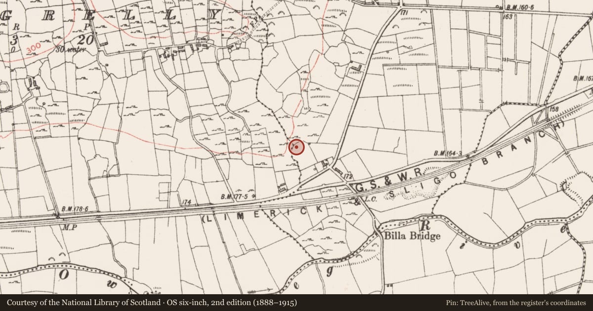
Slide toward Today to fade the historical sheet and see the modern map underneath.
David Rumsey Map Collection, Stanford LibrariesDavid Rumsey Map Collection, Stanford LibrariesDavid Rumsey Map Collection, Stanford LibrariesDavid Rumsey Map Collection, Stanford Libraries
4 historical maps cover this location, the earliest the 1790 map "Composite: Ireland." (David Rumsey Map Collection, Stanford Libraries).
Historical maps covering this location
- 1790 · Composite: Ireland. (David Rumsey Map Collection, Stanford Libraries)
- 1869 · Ireland. (David Rumsey Map Collection, Stanford Libraries)
- 1891 · Ireland 16 (David Rumsey Map Collection, Stanford Libraries)
- 1904 · Sheet 4. (David Rumsey Map Collection, Stanford Libraries)
This record in the National Monuments Service's Historic Environment Viewer ↗
The National Monuments Service's description
In relatively level ground. This monument was identified in 2011 during groundworks prior to the establishment of a garden. The roofstone and a number of adjoining stones were dislodged and collapsed into an approximately circular chamber (dims. c. 2.2m ENE-WSW; c. 2m NNW-SSE; max. H c. 1.2m) constructed of roughly coursed drystone masonry. The wall is best preserved from SW-W. Immediately to the NNW is a very wide drystone wall composed of uncoursed rubble. Portion of this wall has recently collapsed into the chamber. The opening to a passage (H. c.1m; Wth. 0.8m) can be seen at the E side of the chamber. The chamber has been backfiled.
Compiled by: Patrick F. O'Donovan
Date of upload: 13 January 2012
Nearby in the register
- Ritual site - holy wellunder 1 mi
- Enclosureunder 1 mi
- Ritual site - holy/saint's stoneunder 1 mi
- Ritual site - holy/saint's stoneunder 1 mi
Other entries of the same register within about three miles of this one, by straight line.