Sites and Monuments Record · Ireland
Church
Kilnamanagh, County Sligo, Ireland
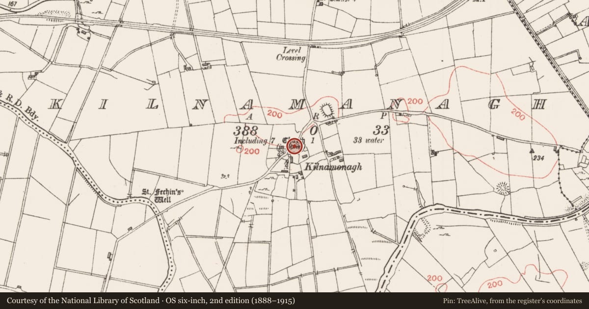
The record
- Townland
- Kilnamanagh
- County
- Sligo
- Country
- Ireland
- Latest-edition OS map
- Church (in Ruins)
- Coordinates
- 54.18023, -8.52668
- SMR number
- SL026-016----
Slide toward Today to fade the historical sheet and see the modern map underneath.
David Rumsey Map Collection, Stanford LibrariesDavid Rumsey Map Collection, Stanford LibrariesDavid Rumsey Map Collection, Stanford LibrariesDavid Rumsey Map Collection, Stanford Libraries
4 historical maps cover this location, the earliest the 1790 map "Composite: Ireland." (David Rumsey Map Collection, Stanford Libraries).
Historical maps covering this location
- 1790 · Composite: Ireland. (David Rumsey Map Collection, Stanford Libraries)
- 1869 · Ireland. (David Rumsey Map Collection, Stanford Libraries)
- 1891 · Ireland 16 (David Rumsey Map Collection, Stanford Libraries)
- 1904 · Sheet 4. (David Rumsey Map Collection, Stanford Libraries)
This record in the National Monuments Service's Historic Environment Viewer ↗
The National Monuments Service's description
In undulating rocky pasture, in the immediate vicinity of the partially deserted settlement cluster of Kilnamonagh. According to McParlan (1802, 108) this is the site of an 'ancient abbey' founded by St Fechin and also a 'parish church'; Gwynn and Hadcock (1970, 183) state that 'a small cell' of the Augustinian monastery of Ballysadare (SL020-108----) was founded here shortly after AD 1140 but it does not appear to have survived into the 15th century. According to local tradition, there was an associated graveyard (SL026-016001-). Test trenching, c. 110m NE of the church site, uncovered a pit containing metal slag but no evidence of a monastic enclosure (M. A. Timoney 2001a, 303). St Fechin's well (SL026-015----) is c. 350m to SW. A rectangular enclosure (SL026-017----) lies c. 130m to NE.
The above description is derived from the published 'Archaeological Inventory of County Sligo' compiled by Ursula Egan, Elizabeth Byrne, Mary Sleeman with Sheila Ronan and Connie Murphy (Dublin Stationery Office, 2005).
Date of upload: 18 January 2008
Nearby in the register
- House - indeterminate dateunder 1 mi
- Enclosureunder 1 mi
- Ritual site - holy wellunder 1 mi
- Moated siteunder 1 mi
Other entries of the same register within about three miles of this one, by straight line.