Sites and Monuments Record · Ireland
Church
Killanly, County Sligo, Ireland
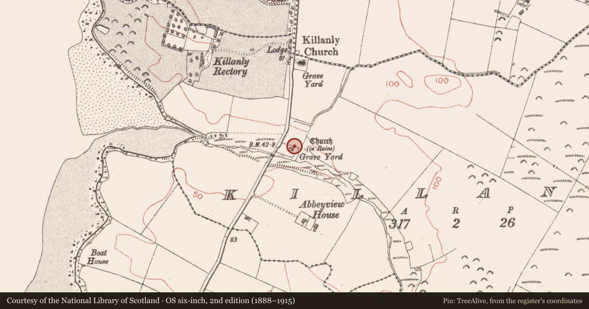
The record
- Townland
- Killanly
- County
- Sligo
- Country
- Ireland
- First-edition OS map
- Church
- Latest-edition OS map
- Church (in Ruins)
- Coordinates
- 54.16759, -9.12528
- SMR number
- SL022-015001-
Slide toward Today to fade the historical sheet and see the modern map underneath.
David Rumsey Map Collection, Stanford LibrariesDavid Rumsey Map Collection, Stanford LibrariesDavid Rumsey Map Collection, Stanford LibrariesDavid Rumsey Map Collection, Stanford Libraries
4 historical maps cover this location, the earliest the 1790 map "Composite: Ireland." (David Rumsey Map Collection, Stanford Libraries).
Historical maps covering this location
- 1790 · Composite: Ireland. (David Rumsey Map Collection, Stanford Libraries)
- 1841 · Ireland. (David Rumsey Map Collection, Stanford Libraries)
- 1869 · Ireland. (David Rumsey Map Collection, Stanford Libraries)
- 1891 · Ireland 16 (David Rumsey Map Collection, Stanford Libraries)
This record in the National Monuments Service's Historic Environment Viewer ↗
The National Monuments Service's description
In a graveyard (SL022-015002-), situated at the base of a narrow E-W valley adjacent to the N bank of a W-flowing stream. Milligan (ITA Survey 1942-4) recorded that this church is 'supposed to have been erected by St. Ainle or Fainle who lived in the 5th or 6th centuries'. The upstanding remains are of a very ruined, late medieval church (18.5m E-W; 9.5m N-S; Wall T 0.93m). Much of the stone from the church has been robbed and used to mark burials in the graveyard (sl022-015002-) within which it is located. The E wall contains a large, broken-out window opening. Only the lower portion of the W wall, which has a marked base batter but is otherwise featureless, is still extant. There is a short length of upstanding wall, containg a possible window opeining, at the E end of the S wall. Only the basal portion of the remainder of the S wall and the foundations of the N wall, punctuated by modern graves are still identifiable. A font (SL022-015003-) was removed from this church and its presnet location (SL022-014001-) is now in the modern Catholic church at Corballa in Rathglass townland.
Compiled by: Patrick F. O'Donovan
Date of upload: 19 January 2011
Nearby in the register
- Fontunder 1 mi
- Graveyardunder 1 mi
- Kiln - limeunder 1 mi
- Structureunder 1 mi
Other entries of the same register within about three miles of this one, by straight line.