Sites and Monuments Record · Ireland
Ringfort - rath
Rathglass (Tireragh By., Castleconor West ED), County Sligo, Ireland
The record
- Townland
- Rathglass (Tireragh By., Castleconor West ED)
- County
- Sligo
- Country
- Ireland
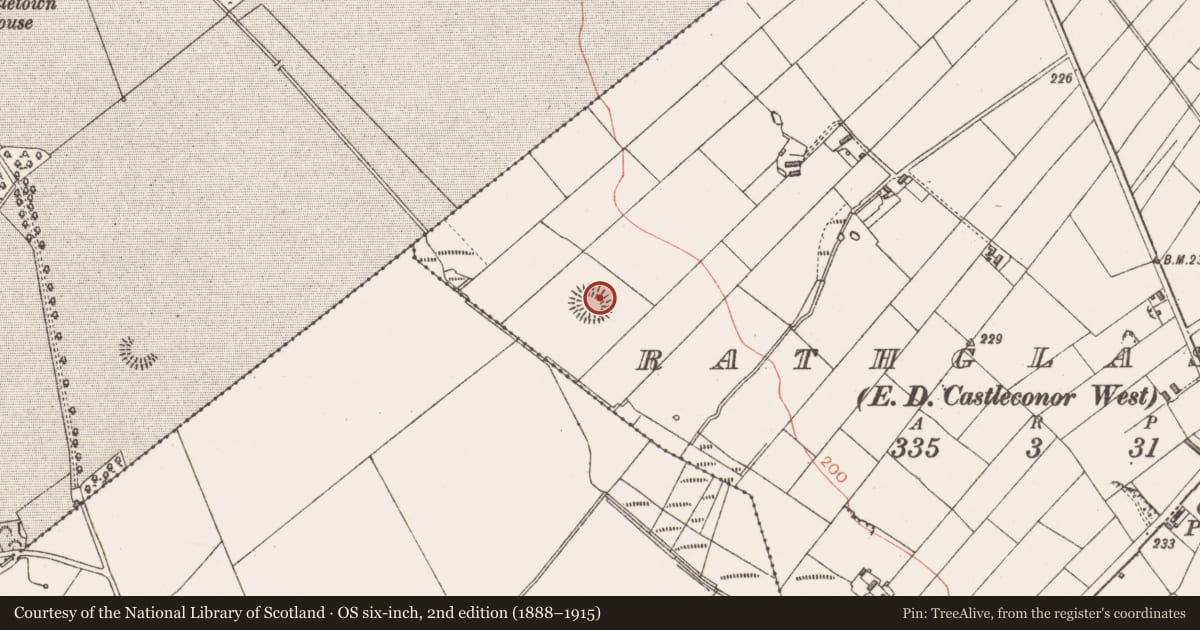
- First-edition OS map
- Indicated
- Latest-edition OS map
- Hachured
- Coordinates
- 54.17390, -9.07247
- SMR number
- SL022-013----
Slide toward Today to fade the historical sheet and see the modern map underneath.
David Rumsey Map Collection, Stanford LibrariesDavid Rumsey Map Collection, Stanford LibrariesDavid Rumsey Map Collection, Stanford LibrariesDavid Rumsey Map Collection, Stanford Libraries
4 historical maps cover this location, the earliest the 1790 map "Composite: Ireland." (David Rumsey Map Collection, Stanford Libraries).
Historical maps covering this location
- 1790 · Composite: Ireland. (David Rumsey Map Collection, Stanford Libraries)
- 1841 · Ireland. (David Rumsey Map Collection, Stanford Libraries)
- 1869 · Ireland. (David Rumsey Map Collection, Stanford Libraries)
- 1891 · Ireland 16 (David Rumsey Map Collection, Stanford Libraries)
This record in the National Monuments Service's Historic Environment Viewer ↗
The National Monuments Service's description
Situated on an area of level ground in undulating pasture. Oval area (30m NW-SE; 26m NE-SW) enclosed by a substantial earthen bank (Wth 5.3-5.7m; int. H 1.5-1.8m; ext. H 1.3-1.6m) outside which at SSE-WNW is an external fosse (Wth 2.4m). At the outer foot of the fosse at SSE-WNW is a second bank (Wth 1.5m; int. H 0.8m; ext. H 0.9m) with an external fosse (Wth 2.5m) and a third bank (Wth 1.8m; int. H 0.4m; ext. H 1m). There is a break (Wth 3m) in the inner bank at E. At SW there is a another break (Wth 3.5-4m) in the inner bank and corresponing breaks in the two outer banks. Adjacent to this in the interior is an irregularly-shaped sod-covered mound (9.8m N-S; 8.8m E-W - H 1.8m). Located against the inner face of the bank at NE and S are two hollows (max dim. c. 6-8m; D 0.3-0.5m). The mound and and hollows appear to be the result of relatively modern disturbance.
Compiled by: Patrick F. O'Donovan
Date of upload: 19 January 2011
Nearby in the register
- Ringfort - rathunder 1 mi
- Ringfort - unclassifiedunder 1 mi
- Font (present location)under 1 mi
- Cross (present location)under 1 mi
Other entries of the same register within about three miles of this one, by straight line.