Sites and Monuments Record · Ireland
Bridge
Ballysadare,Kilboglashy,Knockmuldoney,Knoxspark, County Sligo, Ireland
The record
- Townland
- Ballysadare,Kilboglashy,Knockmuldoney,Knoxspark
- County
- Sligo
- Country
- Ireland
- Latest-edition OS map
- Not indicated
- Coordinates
- 54.20954, -8.50937
- SMR number
- SL020-268----
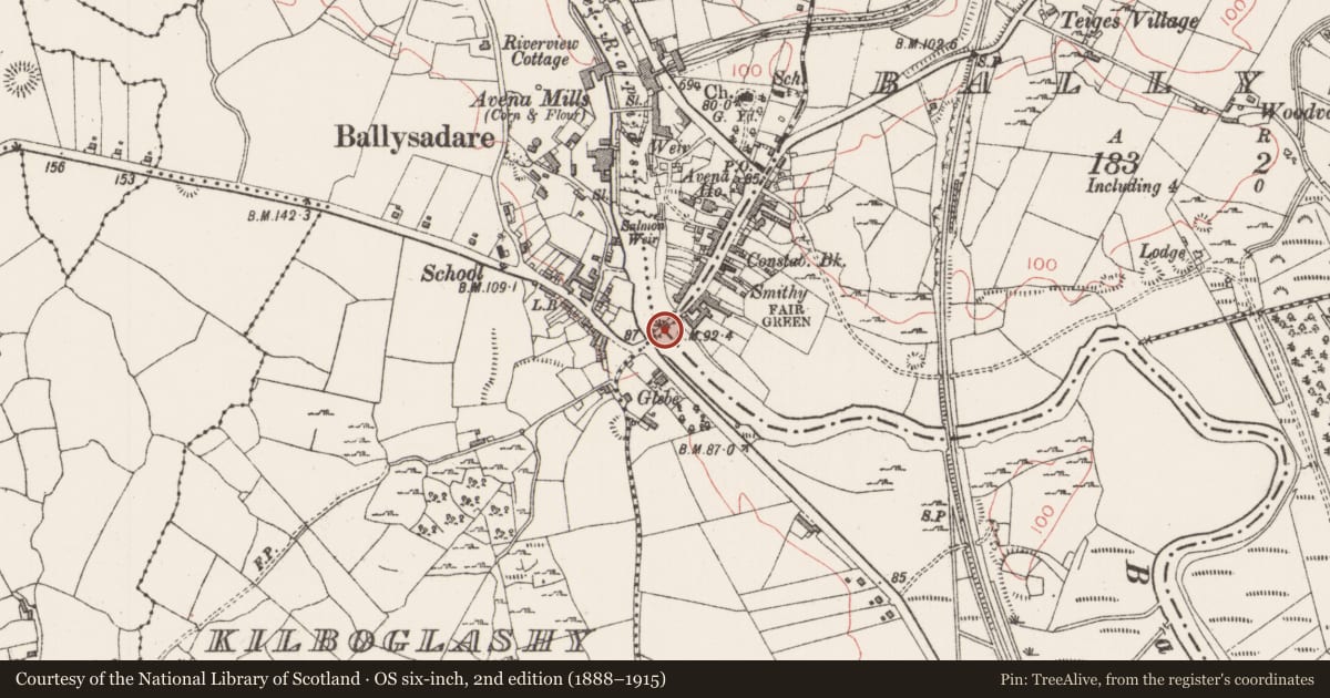
Slide toward Today to fade the historical sheet and see the modern map underneath.
David Rumsey Map Collection, Stanford LibrariesDavid Rumsey Map Collection, Stanford LibrariesDavid Rumsey Map Collection, Stanford LibrariesDavid Rumsey Map Collection, Stanford Libraries
4 historical maps cover this location, the earliest the 1790 map "Composite: Ireland." (David Rumsey Map Collection, Stanford Libraries).
Historical maps covering this location
- 1790 · Composite: Ireland. (David Rumsey Map Collection, Stanford Libraries)
- 1869 · Ireland. (David Rumsey Map Collection, Stanford Libraries)
- 1891 · Ireland 16 (David Rumsey Map Collection, Stanford Libraries)
- 1904 · Sheet 4. (David Rumsey Map Collection, Stanford Libraries)
This record in the National Monuments Service's Historic Environment Viewer ↗
The National Monuments Service's description
A bridge over the Ballysadare River is indicated on the Down Survey (1655-6) barony map (1654-57) at the town of Ballysadare. There are now no visible remains of this bridge. The present road bridge (on a NE-SW axis; Wth c. 6m) which is of 18th-century appearance is on the SW side of Ballysadare town. It has seven segmental arches (span c. 6m) increasing in size towards the centre with dressed voussoirs. The low pointed cutwaters have concrete tops. The core of the bridge is rendered and the arches are underpinned. The bridge has been recently widened with a cantilevered support and iron railing. An earlier bridge (SL020-249----) seems to have existed to NW. Also indicated on the Down Survey (1655-6) barony map (1654-57) is a mill (SL020-273----) on the E bank of the Ballysadare River and down stream from this bridge.
The above description is derived from the published 'Archaeological Inventory of County Sligo' compiled by Ursula Egan, Elizabeth Byrne, Mary Sleeman with Sheila Ronan and Connie Murphy (Dublin Stationery Office, 2005).
Date of upload: 18 January 2008
Nearby in the register
- Earthworkunder 1 mi
- Middenunder 1 mi
- Enclosureunder 1 mi
- Megalithic tomb - unclassifiedunder 1 mi
Other entries of the same register within about three miles of this one, by straight line.