Sites and Monuments Record · Ireland
Cairn - boundary cairn
Cabragh (Leyny By.),Gortakeeran, County Sligo, Ireland
The record
- Townland
- Cabragh (Leyny By.),Gortakeeran
- County
- Sligo
- Country
- Ireland
- First-edition OS map
- Not indicated
- Latest-edition OS map
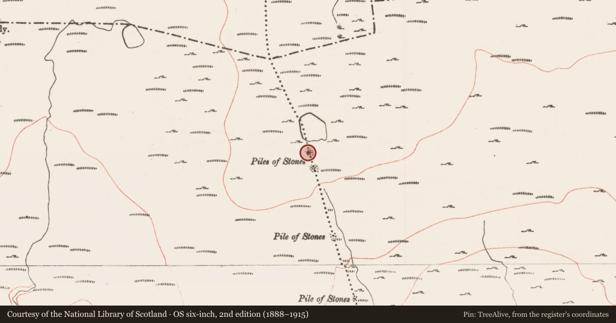
- Piles of Stones
- Coordinates
- 54.18812, -8.67013
- SMR number
- SL019-171001-
Slide toward Today to fade the historical sheet and see the modern map underneath.
David Rumsey Map Collection, Stanford LibrariesDavid Rumsey Map Collection, Stanford LibrariesDavid Rumsey Map Collection, Stanford LibrariesDavid Rumsey Map Collection, Stanford Libraries
4 historical maps cover this location, the earliest the 1790 map "Composite: Ireland." (David Rumsey Map Collection, Stanford Libraries).
Historical maps covering this location
- 1790 · Composite: Ireland. (David Rumsey Map Collection, Stanford Libraries)
- 1869 · Ireland. (David Rumsey Map Collection, Stanford Libraries)
- 1891 · Ireland 16 (David Rumsey Map Collection, Stanford Libraries)
- 1904 · Sheet 4. (David Rumsey Map Collection, Stanford Libraries)
This record in the National Monuments Service's Historic Environment Viewer ↗
The National Monuments Service's description
Listed in the SMR (1989) and the RMP (1995) and classified as 'Cairn Possible'. On the upper bog-covered slopes of the Ox Mountains. This is the most northerly of 10 cairns (see also: SL019-171002-; SL019-172----; SL025-147----; SL025-147001-; SL025-147002-; SL025-147003-; SL025-147004-; SL025-147005-; SL025-147006-) that mark a long linear length of the townland boundary between Cabragh and Gortakeeran. None of the ten are marked of the 1837 edition of the OS 6-inch map. There are no remains of this cairn, in all probability post-1700 AD in date, now visible.
Compiled by: Archaeological Survey Unit, UCC
Date of upload: 13 December 2011
Nearby in the register
- Cairn - boundary cairnunder 1 mi
- Cairn - boundary cairnunder 1 mi
- Cairn - boundary cairnunder 1 mi
- Cairn - boundary cairnunder 1 mi
Other entries of the same register within about three miles of this one, by straight line.