Sites and Monuments Record · Ireland
Midden
Tanrego West, County Sligo, Ireland
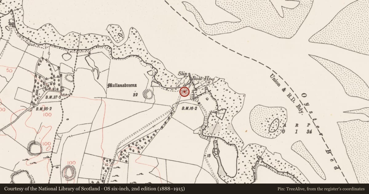
The record
- Townland
- Tanrego West
- County
- Sligo
- Country
- Ireland
- Latest-edition OS map
- Not indicated
- Coordinates
- 54.23461, -8.61511
- SMR number
- SL019-057003-
Slide toward Today to fade the historical sheet and see the modern map underneath.
David Rumsey Map Collection, Stanford LibrariesDavid Rumsey Map Collection, Stanford LibrariesDavid Rumsey Map Collection, Stanford LibrariesDavid Rumsey Map Collection, Stanford Libraries
4 historical maps cover this location, the earliest the 1790 map "Composite: Ireland." (David Rumsey Map Collection, Stanford Libraries).
Historical maps covering this location
- 1790 · Composite: Ireland. (David Rumsey Map Collection, Stanford Libraries)
- 1869 · Ireland. (David Rumsey Map Collection, Stanford Libraries)
- 1891 · Ireland 16 (David Rumsey Map Collection, Stanford Libraries)
- 1904 · Sheet 4. (David Rumsey Map Collection, Stanford Libraries)
This record in the National Monuments Service's Historic Environment Viewer ↗
The National Monuments Service's description
One of seven middens (SL019-057001-, SL019-057002-, SL019-057003-, SL019-057004-, SL019-057005-, SL019-057006-, SL019-057007-) identified along a 1.3km length of shoreline on the W side of Ballisodare Bay, four in Tanrego West townland and three in Tanrego East or Carrowmore townland. Located a short distance W of a modern boat slipway. On inspection in 1994 it was found to consist of a layer of oyster shells (D 0.1m - 0.3m) exposed intermittently for several metres. The deposits are overlain by a collapsed field wall. (Synge 1985, 128)
Compiled by: Paul Walsh
Date of upload: 22 August 2012
Nearby in the register
- Enclosureunder 1 mi
- House - indeterminate dateunder 1 mi
- Middenunder 1 mi
- Ringfort - rathunder 1 mi
Other entries of the same register within about three miles of this one, by straight line.