Sites and Monuments Record · Ireland
Castle - tower house
Cashelboy, County Sligo, Ireland
The record
- Townland
- Cashelboy
- County
- Sligo
- Country
- Ireland
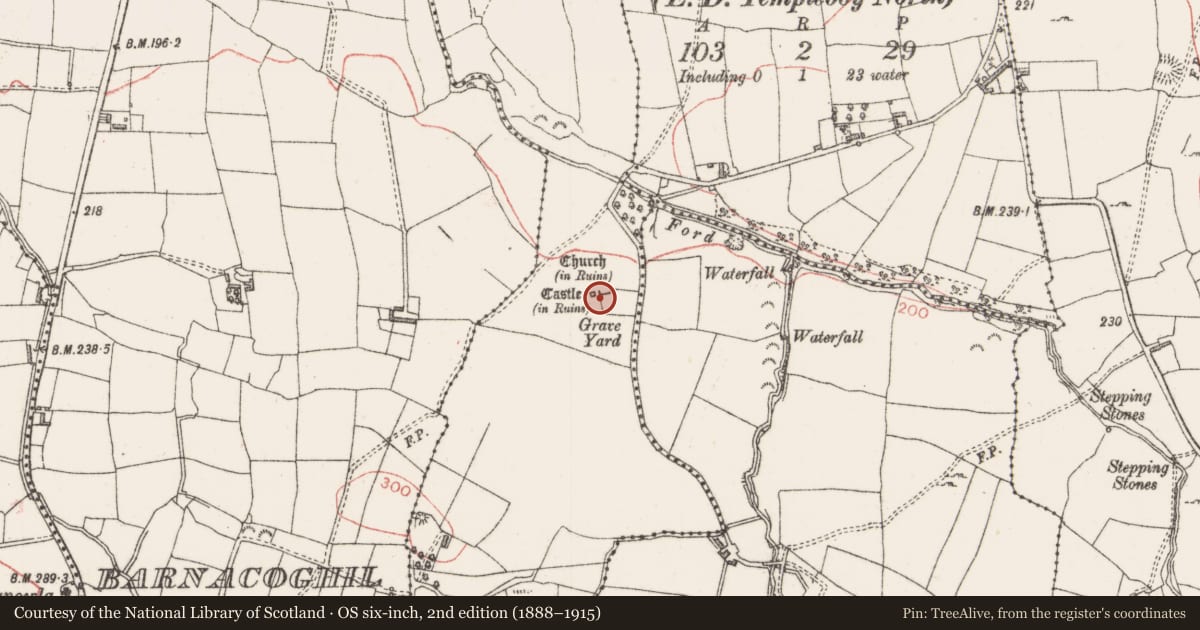
- First-edition OS map
- Castle
- Latest-edition OS map
- Castle (in Ruins)
- Coordinates
- 54.23670, -8.81858
- SMR number
- SL018-029001-
Slide toward Today to fade the historical sheet and see the modern map underneath.
David Rumsey Map Collection, Stanford LibrariesDavid Rumsey Map Collection, Stanford LibrariesDavid Rumsey Map Collection, Stanford LibrariesDavid Rumsey Map Collection, Stanford Libraries
4 historical maps cover this location, the earliest the 1790 map "Composite: Ireland." (David Rumsey Map Collection, Stanford Libraries).
Historical maps covering this location
- 1790 · Composite: Ireland. (David Rumsey Map Collection, Stanford Libraries)
- 1869 · Ireland. (David Rumsey Map Collection, Stanford Libraries)
- 1891 · Ireland 16 (David Rumsey Map Collection, Stanford Libraries)
- 1904 · Sheet 4. (David Rumsey Map Collection, Stanford Libraries)
This record in the National Monuments Service's Historic Environment Viewer ↗
The National Monuments Service's description
Situated on a N-facing slope in hilly pasture. Cashelboy church (SL018-029002-) is 5.5m E. Late 16th century, square, two-storey, limestone-built tower house (dim. 7.7m - Wall T 1.4m) with a slight base batter. There is a N-S barrel vault over ground floor level with loft over. The entrance, at the S end of the E wall, gives access to the vaulted area. A spiral stairwell immediately N of the entrance gives access to first floor level. The stairwell is lit by a single slit ope at ground floor level and by two others at first floor level. At first floor level an intermural passage in the S wall leads to a garderobe in the SW angle. An intermural passage commencing in the NE angle leads to an oubliette in the centre of the E wall. There are a number of windows at first floor level. In the E wall is a large round-headed window with late 16th century dressing and in the N wall a small slit ope. There are broken-out, flat-headed, single-light windows in the W and S walls. There are large rectangular niches on either side of the windows in the W and N walls. There is no evidence for a second floor or for battlements.
Compiled by: Patrick F. O'Donovan
Date of upload: 19 January 2011
Nearby in the register
- Churchunder 1 mi
- Graveyardunder 1 mi
- Standing stoneunder 1 mi
- Barrow - mound barrowunder 1 mi
Other entries of the same register within about three miles of this one, by straight line.