Sites and Monuments Record · Ireland
Church
Kilglass, County Sligo, Ireland
The record
- Townland
- Kilglass
- County
- Sligo
- Country
- Ireland
- First-edition OS map
- Chapel
- Latest-edition OS map
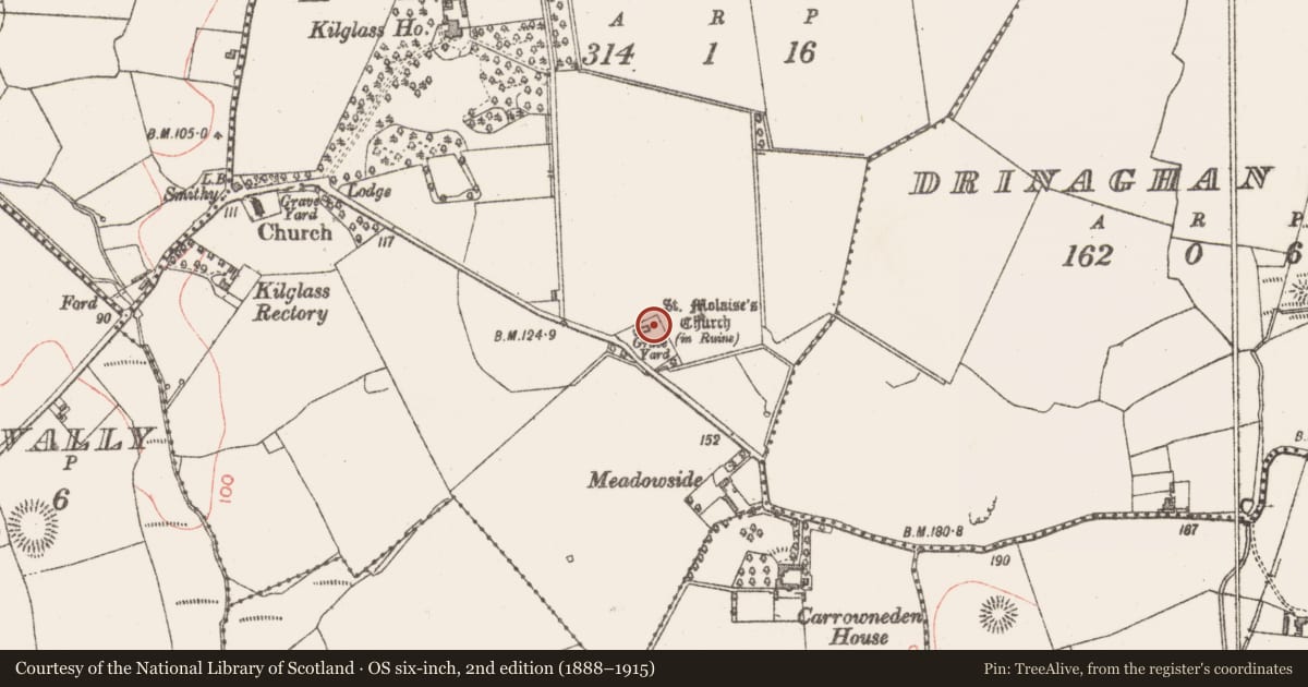
- St. Molaises Church (in Ruins)
- Coordinates
- 54.22931, -9.05324
- SMR number
- SL016-011001-
Slide toward Today to fade the historical sheet and see the modern map underneath.
David Rumsey Map Collection, Stanford LibrariesDavid Rumsey Map Collection, Stanford LibrariesDavid Rumsey Map Collection, Stanford LibrariesDavid Rumsey Map Collection, Stanford Libraries
4 historical maps cover this location, the earliest the 1790 map "Composite: Ireland." (David Rumsey Map Collection, Stanford Libraries).
Historical maps covering this location
- 1790 · Composite: Ireland. (David Rumsey Map Collection, Stanford Libraries)
- 1841 · Ireland. (David Rumsey Map Collection, Stanford Libraries)
- 1869 · Ireland. (David Rumsey Map Collection, Stanford Libraries)
- 1891 · Ireland 16 (David Rumsey Map Collection, Stanford Libraries)
This record in the National Monuments Service's Historic Environment Viewer ↗
The National Monuments Service's description
On a low rise in pasture, located at the N end of a subrectangular, walled graveyard (SL016-011002-). Traditionally believed to be the site of an early monastery founded by St. Molaisse (local information). The present remains are of a late 16th century parish church (20.9m E-W; 7.35m N-S; Wall T 0.85m), whose walls survive to full height. Large, almost flat-headed window in E wall. At the W end of the S wall is doorway with rear flat segmental arch and external pointed two-centered arch, and three windows with almost flat-headed segmental arches. Close to the E end of this wall is a single slit ope with rear splay while at the E end proper is a large rectangular recess, probably a piscina. At the W end of the N wall is a window with an almost flat-headed segmental arch. The E end of this wall has a heavy covering of ivy. Nonetheless two blocked-up opes are visible. There is evidence for a second storey, probably a priest's residence, over the W end. Within the church is the tomb (SL016-011004-) of James Wood d. 1692 which was restored by a relative in 1861.
Compiled by: Patrick F. O'Donovan
Date of upload: 19 January 2011
Nearby in the register
- Tomb - unclassifiedunder 1 mi
- Graveyardunder 1 mi
- Crossunder 1 mi
- Designed landscape featureunder 1 mi
Other entries of the same register within about three miles of this one, by straight line.