Sites and Monuments Record · Ireland
Megalithic tomb - passage tomb
Knocknarea South, County Sligo, Ireland
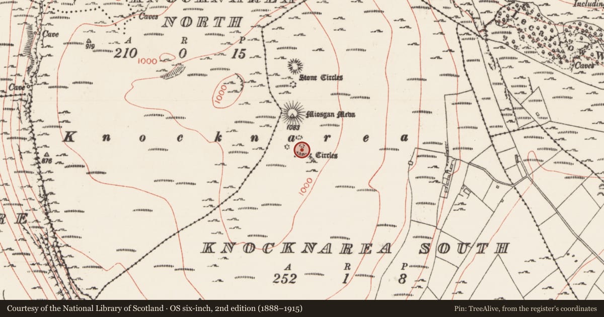
The record
- Townland
- Knocknarea South
- County
- Sligo
- Country
- Ireland
- Latest-edition OS map
- Not indicated
- Coordinates
- 54.25792, -8.57430
- SMR number
- SL014-076007-
Slide toward Today to fade the historical sheet and see the modern map underneath.
David Rumsey Map Collection, Stanford LibrariesDavid Rumsey Map Collection, Stanford LibrariesDavid Rumsey Map Collection, Stanford LibrariesDavid Rumsey Map Collection, Stanford Libraries
4 historical maps cover this location, the earliest the 1790 map "Composite: Ireland." (David Rumsey Map Collection, Stanford Libraries).
Historical maps covering this location
- 1790 · Composite: Ireland. (David Rumsey Map Collection, Stanford Libraries)
- 1869 · Ireland. (David Rumsey Map Collection, Stanford Libraries)
- 1891 · Ireland 16 (David Rumsey Map Collection, Stanford Libraries)
- 1904 · Sheet 4. (David Rumsey Map Collection, Stanford Libraries)
This record in the National Monuments Service's Historic Environment Viewer ↗
The National Monuments Service's description
On the summit of Knocknarae Mountain, located 60m S of a large passage tomb, known as Maeve’s Cairn (MA014-076003-), and 18m to S of a possible passage tomb (MA014-076005-). There are two cairns (MA014-076008-; MA014-076008-) located 8m to SSW and 30m to SE respectively.
There are scant remains of this possible passage tomb. It was described by Wood-Martin (1888, 111) as ‘…a ruined circle, of which eight stones only, and four of the cist, now remain…’. It is evident now as a loose, irregular cluster of twelve gneiss boulders, with only one boulder set upright (H 0.7m). It may have been disturbed in the early 1800’s by Richard Chamber Walker, a local landowner and antiquarian. (Bergh 1995, 241). This is a National Monument (No. 153) in state ownership.
Attached image:
SL014-076007-_01 Viewed from S
Compiled by: Jane O’Shaughnessy
Date of upload: 6 April 2020
References
Bergh, S. 1995 Landscape of the monuments. Stockholm. Bureau for Archaeological Excavation.
Wood-Martin, W.G. 1888 The rude stone monuments of Ireland (Co. Sligo and the island of Achill). Hodges Figgis, Dublin.
Nearby in the register
- Cairn - unclassifiedunder 1 mi
- Megalithic tomb - passage tombunder 1 mi
- Moundunder 1 mi
- Megalithic tomb - passage tombunder 1 mi
Other entries of the same register within about three miles of this one, by straight line.